Jos night lights from space
Night Light of Jos (Plateau) from space (Nigeria) Src. Average luminocity for 10x10km area is 45.124% and for 50x50km: 4.9035%.
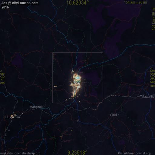
Analysis of Jos night lights 2016
Square area 10x10 km:
 0%
0%90-99
8.06%80-89
12.6%70-79
5.79%60-69
5.58%50-59
9.3%40-49
8.68%30-39
9.5%20-29
12.4%10-19
23.76%0-9
4.34%Square area 50x50 km:
0.02%90-99
0.49%80-89
0.87%70-79
0.5%60-69
0.8%50-59
1%40-49
1.14%30-39
1.44%20-29
1.1%10-19
4.17%0-9
88.48%Clear (daylight) street map image can be seen on geolist.org.
Map coordinates:
10° 37' 13.2" North, 8° 11' 20.4" East
9° 55' 42.6" North, 8° 53' 31.6" East
9° 14' 6.6" North, 9° 35' 42.9" East
Some cities around Jos sort by population:
• Lere
61.7 km =38.3 mi,  325°
325°
• Kagoro
65.5 km =40.7 mi,  237°
237°
• Bukuru
15.3 km =9.5 mi,  191°
191°
• Lere
54.8 km =34.1 mi,  116°
116°
• Vom
24.8 km =15.4 mi,  206°
206°
• Panyam
67.9 km =42.2 mi,  148°
148°
• Saminaka
58.3 km =36.2 mi,  337°
337°
• Lame
68.6 km =42.6 mi,  33°
33°
2335953 (p: 816,824)
Sources (retrieved 2019-11-25):
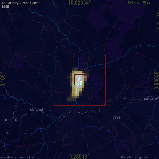
» NASA, Earths city lights 1995
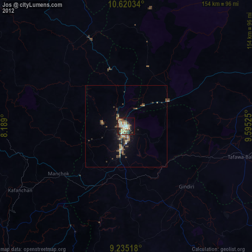
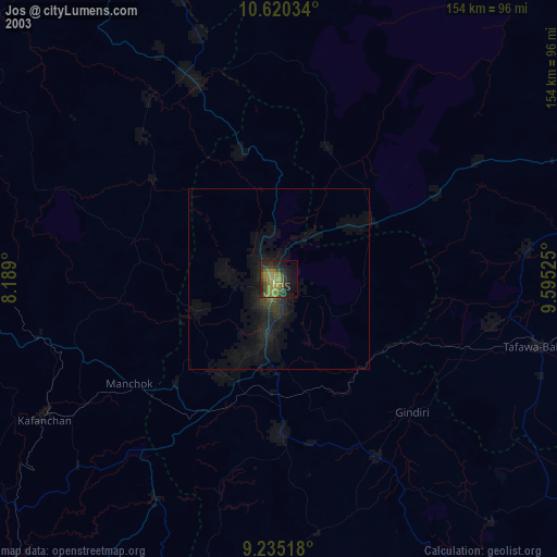
» NASA city lights 2003
» Earth at Night: Flat Maps 2012, 2016