Iho night lights from space
Night Light of Iho (Imo) from space (Nigeria) Src. Average luminocity for 10x10km area is 2.4256% and for 50x50km: 2.4005%.
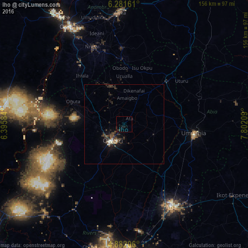
Analysis of Iho night lights 2016
Square area 10x10 km:
100  0%
0%
90-99 0%
80-89 0%
70-79 0%
60-69 0%
50-59 0%
40-49 0.21%
30-39 3.93%
20-29 0%
10-19 2.89%
0-9 92.98%
0%90-99
0%80-89
0%70-79
0%60-69
0%50-59
0%40-49
0.21%30-39
3.93%20-29
0%10-19
2.89%0-9
92.98%Square area 50x50 km:
100 0.08%
90-99 0.44%
80-89 0.03%
70-79 0.06%
60-69 0.1%
50-59 0.39%
40-49 0.75%
30-39 1.24%
20-29 0.88%
10-19 2.09%
0-9 93.93%
0.08%90-99
0.44%80-89
0.03%70-79
0.06%60-69
0.1%50-59
0.39%40-49
0.75%30-39
1.24%20-29
0.88%10-19
2.09%0-9
93.93%Clear (daylight) street map image can be seen on geolist.org.
Map coordinates:
6° 16' 53.8" North, 6° 23' 45" East
5° 34' 56.1" North, 7° 5' 56.3" East
4° 52' 55.4" North, 7° 48' 7.5" East
Some cities around Iho sort by population:
• Owerri
13.2 km =8.2 mi,  213°
213°
• Okigwe
39.1 km =24.3 mi,  45°
45°
• Ihiala
40.3 km =25 mi,  318°
318°
• Uga
39.4 km =24.5 mi,  356°
356°
• Nkwerre
19.7 km =12.2 mi,  1°
1°
• Oguta
35.1 km =21.8 mi,  293°
293°
• Orlu
24.8 km =15.4 mi,  343°
343°
• Orodo
8.2 km =5.1 mi,  297°
297°
2338469 (p: 7,776)
Sources (retrieved 2019-11-25):
» Earth at Night: Flat Maps 2012, 2016