Ijebu-Igbo night lights from space
Night Light of Ijebu-Igbo (Ogun) from space (Nigeria) Src. Average luminocity for 10x10km area is 0% and for 50x50km: 0.6434%.
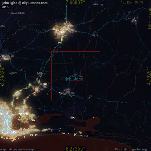
Analysis of Ijebu-Igbo night lights 2016
Square area 10x10 km:
 0%
0%90-99
0%80-89
0%70-79
0%60-69
0%50-59
0%40-49
0%30-39
0%20-29
0%10-19
0%0-9
100%Square area 50x50 km:
0%90-99
0.03%80-89
0%70-79
0%60-69
0.08%50-59
0.06%40-49
0.08%30-39
0.43%20-29
0.8%10-19
0.41%0-9
98.11%Clear (daylight) street map image can be seen on geolist.org.
Map coordinates:
7° 40' 9.7" North, 3° 17' 46.5" East
6° 58' 19.1" North, 3° 59' 57.8" East
6° 16' 24.8" North, 4° 42' 9" East
Some cities around Ijebu-Igbo sort by population:
• Ibadan
46.3 km =28.8 mi,  347°
347°
• Ikire
48.8 km =30.3 mi,  24°
24°
• Shagamu
41.3 km =25.7 mi,  250°
250°
• Epe
43.2 km =26.8 mi,  182°
182°
• Apomu
46.8 km =29.1 mi,  25°
25°
• Iperu
37.5 km =23.3 mi,  259°
259°
• Ejirin
41.3 km =25.7 mi,  195°
195°
• Isara
35.2 km =21.9 mi,  273°
273°
2338403 (p: 109,261)
Sources (retrieved 2019-11-25):
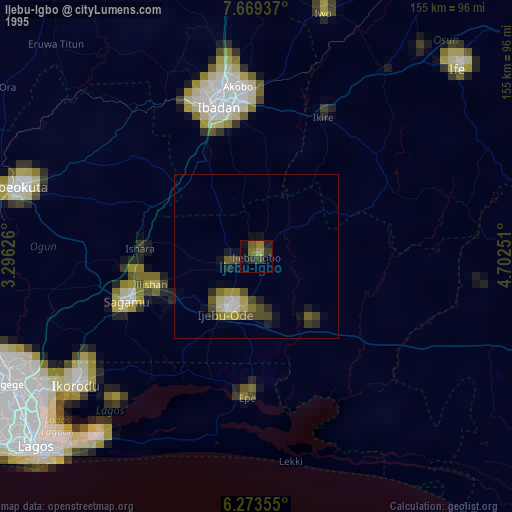
» NASA, Earths city lights 1995
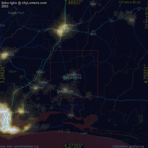
» NASA city lights 2003
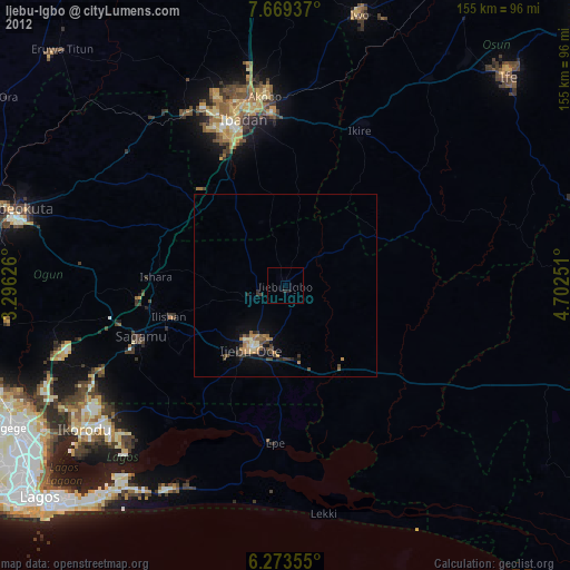
» Earth at Night: Flat Maps 2012, 2016