Iperu night lights from space
Night Light of Iperu (Ogun) from space (Nigeria) Src. Average luminocity for 10x10km area is 18.7294% and for 50x50km: 7.2093%.
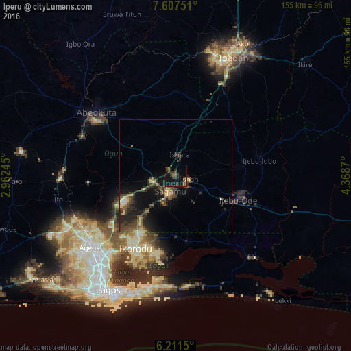
Analysis of Iperu night lights 2016
Square area 10x10 km:
 0%
0%90-99
0%80-89
0%70-79
0.87%60-69
3.68%50-59
3.9%40-49
7.14%30-39
8.23%20-29
9.52%10-19
26.41%0-9
40.26%Square area 50x50 km:
0.21%90-99
0.53%80-89
0.61%70-79
0.62%60-69
0.8%50-59
1.64%40-49
2.27%30-39
2.41%20-29
3.3%10-19
5.94%0-9
81.69%Clear (daylight) street map image can be seen on geolist.org.
Map coordinates:
7° 36' 27" North, 2° 57' 44.8" East
6° 54' 36.1" North, 3° 39' 56.1" East
6° 12' 41.4" North, 4° 22' 7.3" East
Some cities around Iperu sort by population:
• Ebute Ikorodu
39.6 km =24.6 mi,  209°
209°
• Shagamu
7.2 km =4.5 mi,  197°
197°
• Ijebu-Ode
29.6 km =18.4 mi,  109°
109°
• Ijebu-Igbo
37.5 km =23.3 mi,  79°
79°
• Ejirin
41.9 km =26 mi,  141°
141°
• Owode
18.2 km =11.3 mi,  283°
283°
• Isara
9.4 km =5.8 mi,  10°
10°
• Ijebu-Ife
43.2 km =26.8 mi, 109°
2337379 (p: 15,935)
Sources (retrieved 2019-11-25):
» Earth at Night: Flat Maps 2012, 2016