Ilobu night lights from space
Night Light of Ilobu (Osun) from space (Nigeria) Src. Average luminocity for 10x10km area is 7.4628% and for 50x50km: 3.0942%.
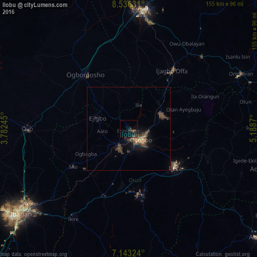
Analysis of Ilobu night lights 2016
Square area 10x10 km:
 0%
0%90-99
0%80-89
0%70-79
0%60-69
0.62%50-59
1.65%40-49
2.69%30-39
5.99%20-29
1.86%10-19
8.88%0-9
78.31%Square area 50x50 km:
0%90-99
0%80-89
0.25%70-79
0.26%60-69
0.48%50-59
0.6%40-49
1.47%30-39
1.47%20-29
0.71%10-19
2.13%0-9
92.63%Clear (daylight) street map image can be seen on geolist.org.
Map coordinates:
8° 32' 10.7" North, 3° 46' 56.8" East
7° 50' 25.3" North, 4° 29' 8.1" East
7° 8' 35.7" North, 5° 11' 19.3" East
Some cities around Ilobu sort by population:
• Ilesa
36.8 km =22.9 mi,  129°
129°
• Iwo
40.5 km =25.2 mi,  235°
235°
• Inisa
17.2 km =10.7 mi,  273°
273°
• Osogbo
11 km =6.8 mi, 134°
• Ejigbo
20.1 km =12.5 mi,  290°
290°
• Ikirun
21.6 km =13.4 mi,  68°
68°
• Oyan
38.8 km =24.1 mi,  53°
53°
• Otan Ayegbaju
35.4 km =22 mi, 70°
2337659 (p: 118,089)
Sources (retrieved 2019-11-25):
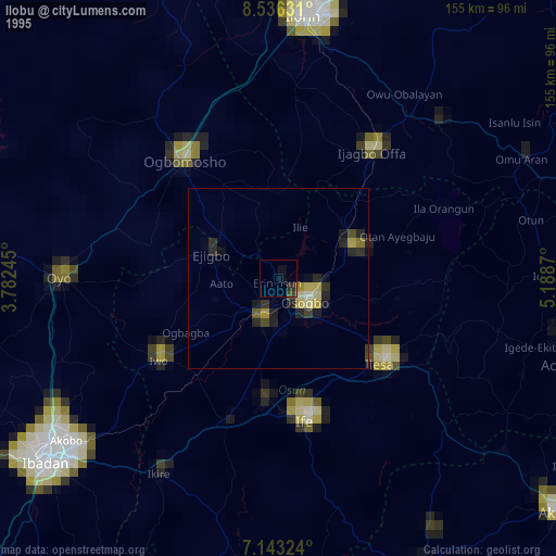
» NASA, Earths city lights 1995
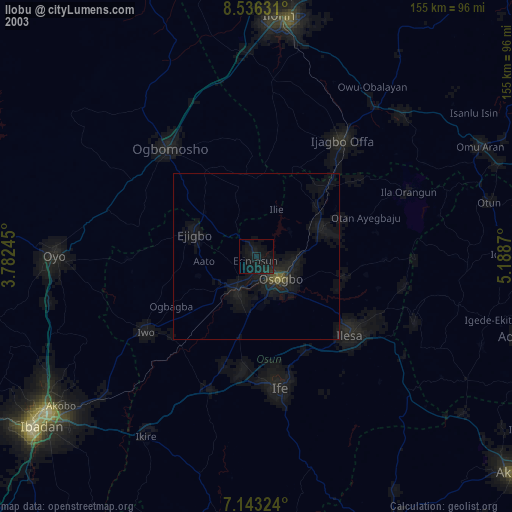
» NASA city lights 2003
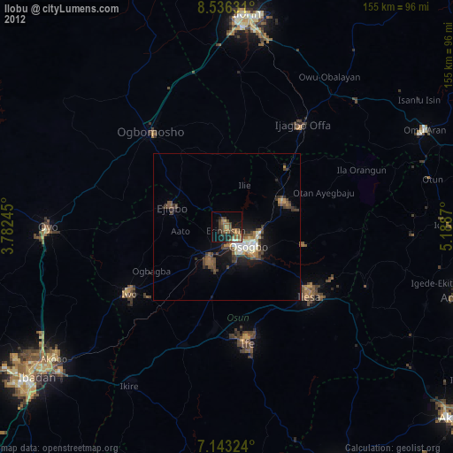
» Earth at Night: Flat Maps 2012, 2016