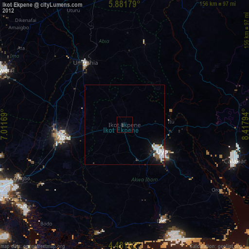
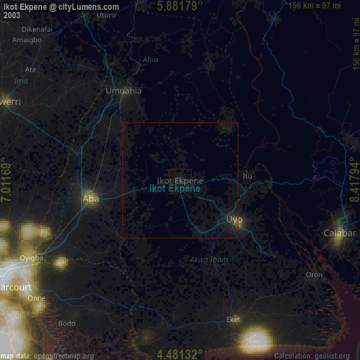
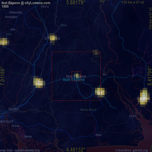
Ikot Ekpene night lights from space
Night Light of Ikot Ekpene (Akwa Ibom) from space (Nigeria) Src. Average luminocity for 10x10km area is 0.6529% and for 50x50km: 1.26%.
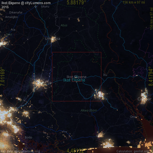
Analysis of Ikot Ekpene night lights 2016
Square area 10x10 km:
 0%
0%90-99
0%80-89
0%70-79
0%60-69
0%50-59
0%40-49
0.83%30-39
0%20-29
0.83%10-19
0%0-9
98.35%Square area 50x50 km:
0.11%90-99
0.3%80-89
0.1%70-79
0%60-69
0.06%50-59
0.09%40-49
0.37%30-39
0.3%20-29
0.48%10-19
1.22%0-9
96.97%Clear (daylight) street map image can be seen on geolist.org.
Map coordinates:
5° 52' 54.4" North, 7° 0' 42.1" East
5° 10' 55" North, 7° 42' 53.3" East
4° 28' 52.8" North, 8° 25' 4.6" East
Some cities around Ikot Ekpene sort by population:
• Aba
39.5 km =24.5 mi,  257°
257°
• Uyo
28.2 km =17.5 mi,  120°
120°
• Umuahia
45.3 km =28.1 mi,  327°
327°
• Bende
42.9 km =26.7 mi,  347°
347°
• Itu
29.9 km =18.6 mi,  85°
85°
• Abak
23.7 km =14.7 mi,  159°
159°
• Arochukwu
31.8 km =19.8 mi,  43°
43°
• Etinan
40.7 km =25.3 mi, 157°
2338106 (p: 254,806)
Sources (retrieved 2019-11-25):
» NASA, Earths city lights 1995
» NASA city lights 2003
» Earth at Night: Flat Maps 2012, 2016