Apomu night lights from space
Night Light of Apomu (Osun) from space (Nigeria) Src. Average luminocity for 10x10km area is 0.2446% and for 50x50km: 0.6943%.
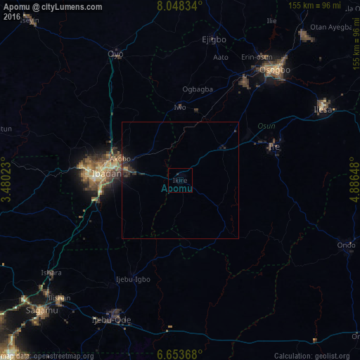
Analysis of Apomu night lights 2016
Square area 10x10 km:
 0%
0%90-99
0%80-89
0%70-79
0%60-69
0%50-59
0%40-49
0%30-39
0%20-29
0.87%10-19
0%0-9
99.13%Square area 50x50 km:
0%90-99
0%80-89
0%70-79
0.04%60-69
0.08%50-59
0.04%40-49
0.05%30-39
0.69%20-29
0.53%10-19
0.59%0-9
97.99%Clear (daylight) street map image can be seen on geolist.org.
Map coordinates:
8° 2' 54" North, 3° 28' 48.8" East
7° 21' 5.6" North, 4° 11' 0.1" East
6° 39' 13.2" North, 4° 53' 11.3" East
Some cities around Apomu sort by population:
• Ibadan
30.7 km =19.1 mi,  275°
275°
• Iwo
31.5 km =19.6 mi,  359°
359°
• Ikire
2.1 km =1.3 mi,  9°
9°
• Gbongan
23.4 km =14.5 mi,  53°
53°
• Modakeke
9.2 km =5.7 mi,  67°
67°
• Ijebu-Igbo
46.8 km =29.1 mi,  205°
205°
• Olupona
27.6 km =17.1 mi, 359°
• Lalupon
18.3 km =11.4 mi,  314°
314°
2349558 (p: 71,656)
Sources (retrieved 2019-11-25):
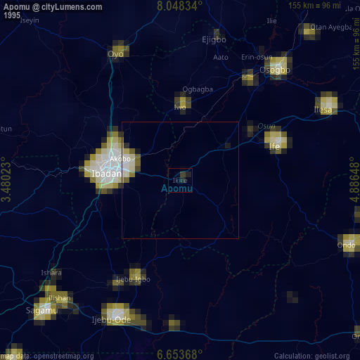
» NASA, Earths city lights 1995
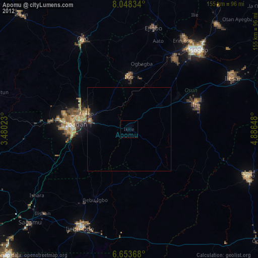
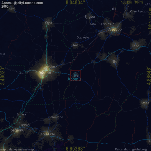
» NASA city lights 2003
» Earth at Night: Flat Maps 2012, 2016