Ajasse Ipo night lights from space
Night Light of Ajasse Ipo (Kwara) from space (Nigeria) Src. Average luminocity for 10x10km area is 0% and for 50x50km: 0.6605%.
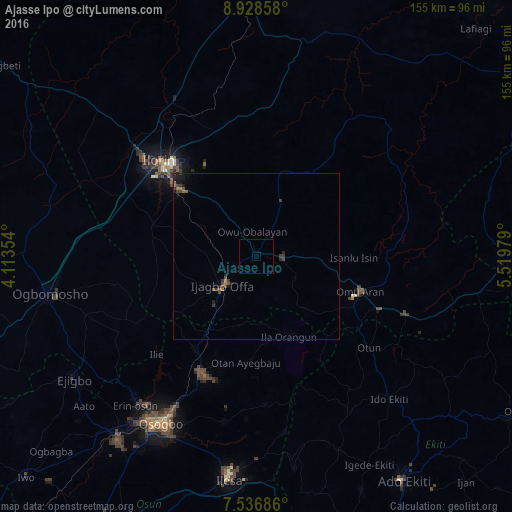
Analysis of Ajasse Ipo night lights 2016
Square area 10x10 km:
 0%
0%90-99
0%80-89
0%70-79
0%60-69
0%50-59
0%40-49
0%30-39
0%20-29
0%10-19
0%0-9
100%Square area 50x50 km:
0%90-99
0%80-89
0%70-79
0%60-69
0.16%50-59
0.14%40-49
0.36%30-39
0.33%20-29
0.22%10-19
0.41%0-9
98.38%Clear (daylight) street map image can be seen on geolist.org.
Map coordinates:
8° 55' 42.9" North, 4° 6' 48.7" East
8° 13' 60" North, 4° 49' 0" East
7° 32' 12.7" North, 5° 31' 11.2" East
Some cities around Ajasse Ipo sort by population:
• Ilorin
42.1 km =26.2 mi,  314°
314°
• Ila Orangun
25.9 km =16.1 mi,  158°
158°
• Ikirun
39.2 km =24.4 mi,  204°
204°
• Offa
14.1 km =8.8 mi,  228°
228°
• Oyan
21.1 km =13.1 mi, 195°
• Otan Ayegbaju
31.9 km =19.8 mi,  185°
185°
• Oke Ila
36.5 km =22.7 mi,  149°
149°
• Omu-Aran
33.2 km =20.6 mi,  108°
108°
2351461 (p: 12,718)
Sources (retrieved 2019-11-25):
» Earth at Night: Flat Maps 2012, 2016