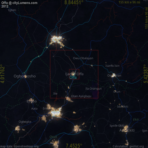
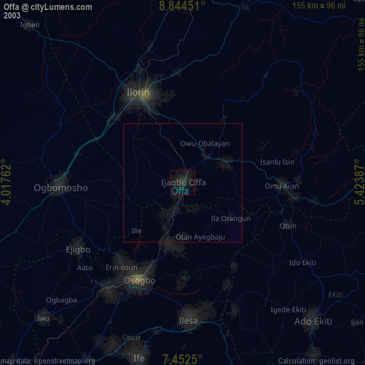
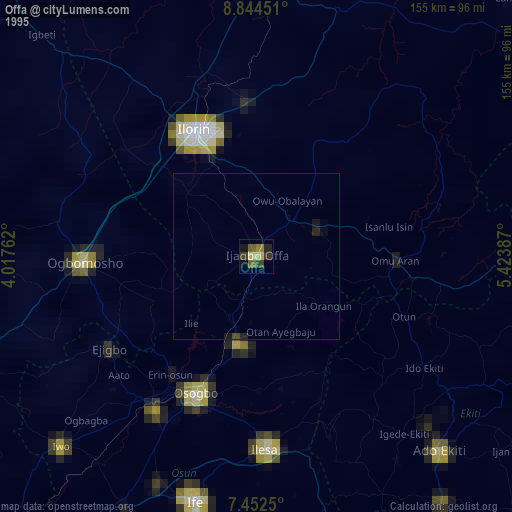
Offa night lights from space
Night Light of Offa (Kwara) from space (Nigeria) Src. Average luminocity for 10x10km area is 6.7376% and for 50x50km: 0.4185%.
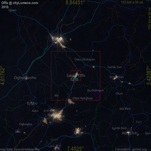
Analysis of Offa night lights 2016
Square area 10x10 km:
 0%
0%90-99
0%80-89
0%70-79
0%60-69
1.65%50-59
1.65%40-49
5.58%30-39
1.45%20-29
2.27%10-19
2.89%0-9
84.5%Square area 50x50 km:
0%90-99
0%80-89
0%70-79
0%60-69
0.07%50-59
0.08%40-49
0.32%30-39
0.19%20-29
0.16%10-19
0.15%0-9
99.03%Clear (daylight) street map image can be seen on geolist.org.
Map coordinates:
8° 50' 40.2" North, 4° 1' 3.4" East
8° 8' 56.8" North, 4° 43' 14.7" East
7° 27' 9" North, 5° 25' 25.9" East
Some cities around Offa sort by population:
• Ila Orangun
25 km =15.5 mi,  125°
125°
• Ikirun
26.9 km =16.7 mi,  192°
192°
• Oke Mesi
42.8 km =26.6 mi,  149°
149°
• Oyan
12.1 km =7.5 mi,  155°
155°
• Otan Ayegbaju
23.6 km =14.7 mi, 161°
• Oke Ila
36.4 km =22.6 mi, 127°
• Omu-Aran
42 km =26.1 mi,  91°
91°
• Ajasse Ipo
14.1 km =8.8 mi,  48°
48°
2327879 (p: 113,830)
Sources (retrieved 2019-11-25):
» NASA, Earths city lights 1995
» NASA city lights 2003
» Earth at Night: Flat Maps 2012, 2016