Niamey night lights from space
Night Light of Niamey from space (Niger) Src. Average luminocity for 10x10km area is 81.0186% and for 50x50km: 7.0279%.
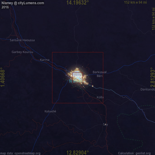
Analysis of Niamey night lights 2016
Square area 10x10 km:
 26.45%
90-99
25.62%80-89
9.5%70-79
15.7%60-69
5.79%50-59
3.31%40-49
4.55%30-39
1.86%20-29
5.58%10-19
1.65%0-9
0%Square area 50x50 km:
1.23%90-99
1.28%80-89
0.64%70-79
1.41%60-69
0.9%50-59
0.63%40-49
0.84%30-39
0.75%20-29
1.82%10-19
4.25%0-9
86.24%Clear (daylight) street map image can be seen on geolist.org.
Map coordinates:
14° 11' 46.8" North, 1° 24' 24" East
13° 30' 49.2" North, 2° 6' 35.3" East
12° 49' 44.5" North, 2° 48' 46.5" East
Some cities around Niamey sort by population:
• Dosso
128.2 km =79.7 mi,  113°
113°
• Diapaga, BF
163.9 km =101.8 mi,  192°
192°
• Téra
156.5 km =97.2 mi,  290°
290°
• Tillabéri
104.7 km =65.1 mi,  317°
317°
• Filingué
160.2 km =99.5 mi,  54°
54°
• Say
53.8 km =33.4 mi,  148°
148°
• Kollo
34 km =21.1 mi,  133°
133°
• Ouallam
89.3 km =55.5 mi,  358°
358°
2440485 (p: 774,235)
Sources (retrieved 2019-11-25):
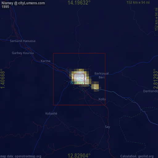
» NASA, Earths city lights 1995
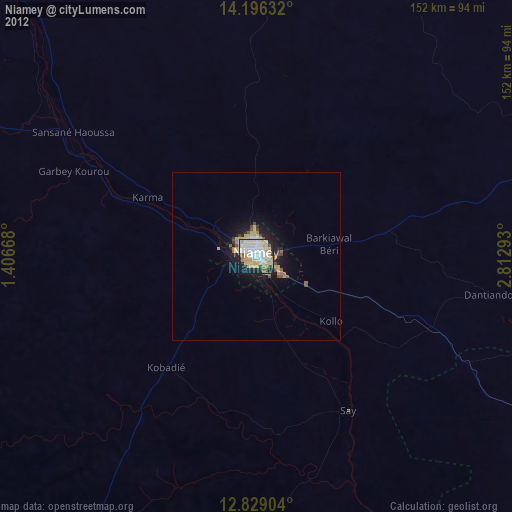
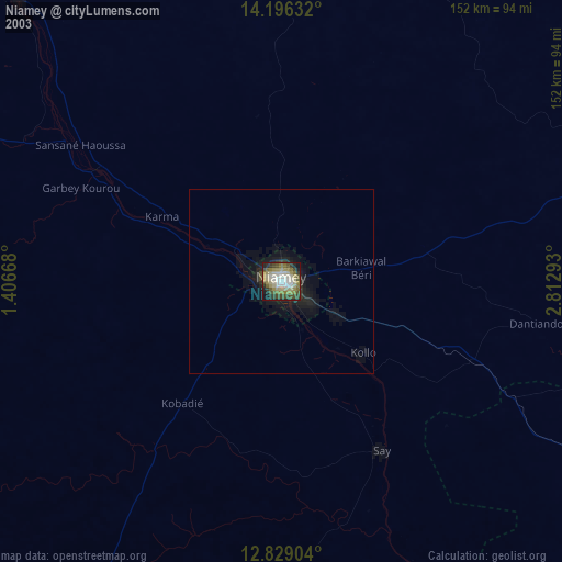
» NASA city lights 2003
» Earth at Night: Flat Maps 2012, 2016