Matola night lights from space
Night Light of Matola (Maputo) from space (Mozambique) Src. Average luminocity for 10x10km area is 76.2282% and for 50x50km: 22.7482%.
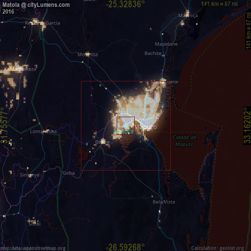

Analysis of Matola night lights 2016
Square area 10x10 km:
 26.59%
90-99
17.46%80-89
12.3%70-79
11.71%60-69
8.33%50-59
3.37%40-49
1.79%30-39
8.73%20-29
8.93%10-19
0.79%0-9
0%Square area 50x50 km:
4.67%90-99
5.28%80-89
3.97%70-79
2.47%60-69
3.32%50-59
1.73%40-49
2.48%30-39
2.63%20-29
4.25%10-19
7.56%0-9
61.64%Clear (daylight) street map image can be seen on geolist.org.
Map coordinates:
25° 19' 42.1" South, 31° 45' 20.8" East
25° 57' 44" South, 32° 27' 32" East
26° 35' 33.6" South, 33° 9' 43.3" East
Some cities around Matola sort by population:
• Maputo
12.4 km =7.7 mi,  91°
91°
• Ressano Garcia
74.1 km =46 mi,  321°
321°
• Macia
122.2 km =75.9 mi,  31°
31°
• Komatipoort, ZA
77.5 km =48.2 mi, 319°
• Big Bend, SZ
108.5 km =67.4 mi,  208°
208°
• Mhlume, SZ
61.4 km =38.2 mi,  262°
262°
• Siteki, SZ
74.7 km =46.4 mi,  223°
223°
• Piggs Peak, SZ
121.2 km =75.3 mi,  270°
270°
1039854 (p: 675,422)
Sources (retrieved 2019-11-25):
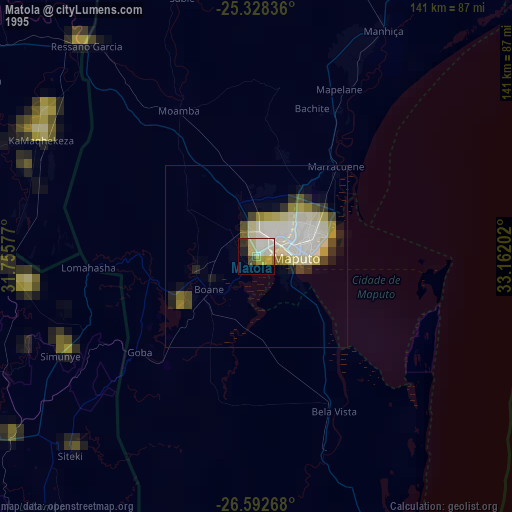
» NASA, Earths city lights 1995
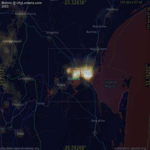
» NASA city lights 2003
» Earth at Night: Flat Maps 2012, 2016