Maputo night lights from space
Night Light of Maputo (Maputo City) from space (Mozambique) Src. Average luminocity for 10x10km area is 71.2044% and for 50x50km: 22.2384%.
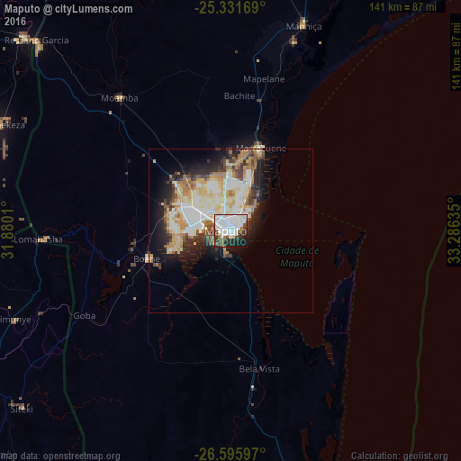

Analysis of Maputo night lights 2016
Square area 10x10 km:
 35.12%
90-99
18.85%80-89
1.59%70-79
0.2%60-69
6.15%50-59
2.78%40-49
9.72%30-39
7.74%20-29
10.71%10-19
6.55%0-9
0.6%Square area 50x50 km:
4.67%90-99
5.25%80-89
3.86%70-79
2.44%60-69
3.23%50-59
1.7%40-49
2.29%30-39
2.41%20-29
4.16%10-19
7.34%0-9
62.65%Clear (daylight) street map image can be seen on geolist.org.
Map coordinates:
25° 19' 54.1" South, 31° 52' 48.4" East
25° 57' 55.9" South, 32° 34' 59.6" East
26° 35' 45.5" South, 33° 17' 10.9" East
Some cities around Maputo sort by population:
• Matola
12.4 km =7.7 mi,  271°
271°
• Ressano Garcia
82.8 km =51.4 mi,  314°
314°
• Macia
116.5 km =72.4 mi,  26°
26°
• Komatipoort, ZA
86.4 km =53.7 mi, 313°
• Big Bend, SZ
114.7 km =71.3 mi,  214°
214°
• Mhlume, SZ
73.7 km =45.8 mi,  264°
264°
• Siteki, SZ
83.4 km =51.8 mi,  229°
229°
• Piggs Peak, SZ
133.6 km =83 mi, 270°
1040652 (p: 1,191,613)
Sources (retrieved 2019-11-25):
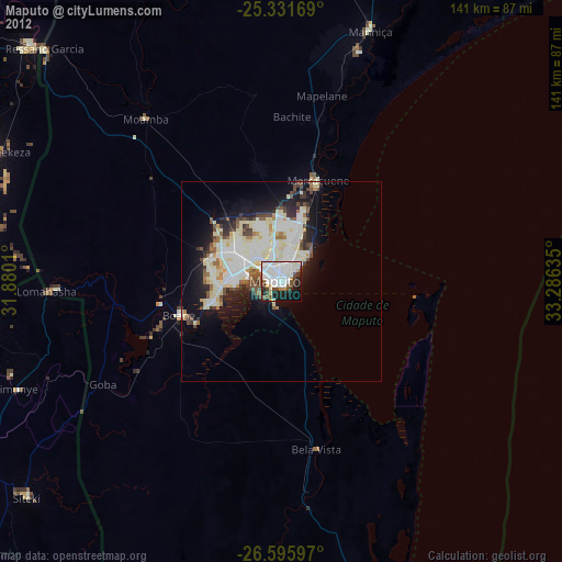
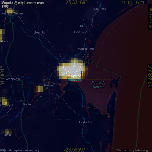
» NASA, Earths city lights 1995
» NASA city lights 2003
» Earth at Night: Flat Maps 2012, 2016