Taman Rajawali night lights from space
Night Light of Taman Rajawali (Sabah) from space (Malaysia) Src. Average luminocity for 10x10km area is 49.6281% and for 50x50km: 4.8947%.
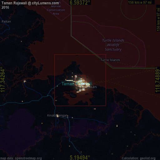
Analysis of Taman Rajawali night lights 2016
Square area 10x10 km:
 7.23%
7.23%90-99
10.95%80-89
7.44%70-79
7.44%60-69
6.61%50-59
10.12%40-49
2.89%30-39
7.02%20-29
14.67%10-19
17.98%0-9
7.64%Square area 50x50 km:
0.39%90-99
0.87%80-89
0.78%70-79
0.56%60-69
0.62%50-59
0.77%40-49
0.55%30-39
0.74%20-29
1.41%10-19
3.8%0-9
89.51%Clear (daylight) street map image can be seen on geolist.org.
Map coordinates:
6° 35' 37.4" North, 117° 20' 33.5" East
5° 53' 41.2" North, 118° 2' 44.7" East
5° 11' 41.8" North, 118° 44' 56" East
Some cities around Taman Rajawali sort by population:
• Sandakan
10 km =6.2 mi,  127°
127°
• Tawau
184.3 km =114.5 mi,  185°
185°
• Lahad Datu
101.9 km =63.3 mi,  162°
162°
• Semporna
169.1 km =105.1 mi, 158°
• Kudat
174.4 km =108.4 mi,  309°
309°
• Ranau
152.9 km =95 mi,  272°
272°
• Sitangkai, PH
202.9 km =126.1 mi, 132°
• Kota Belud
185.6 km =115.3 mi,  285°
285°
8714611 (p: 10,000)
Sources (retrieved 2019-11-25):
» Earth at Night: Flat Maps 2012, 2016