Sandakan night lights from space
Night Light of Sandakan (Sabah) from space (Malaysia) Src. Average luminocity for 10x10km area is 31.0372% and for 50x50km: 4.8907%.
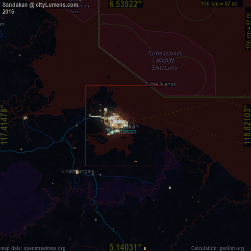
Analysis of Sandakan night lights 2016
Square area 10x10 km:
 2.89%
2.89%90-99
6.2%80-89
4.34%70-79
2.27%60-69
6.61%50-59
6.82%40-49
3.72%30-39
3.51%20-29
4.55%10-19
24.59%0-9
34.5%Square area 50x50 km:
0.39%90-99
0.87%80-89
0.78%70-79
0.56%60-69
0.62%50-59
0.81%40-49
0.52%30-39
0.71%20-29
1.39%10-19
3.8%0-9
89.55%Clear (daylight) street map image can be seen on geolist.org.
Map coordinates:
6° 32' 21.2" North, 117° 24' 53.2" East
5° 50' 24.7" North, 118° 7' 4.4" East
5° 8' 25.1" North, 118° 49' 15.7" East
Some cities around Sandakan sort by population:
• Tawau
179.2 km =111.3 mi,  188°
188°
• Lahad Datu
93.8 km =58.3 mi,  165°
165°
• Semporna
160.6 km =99.8 mi,  160°
160°
• Kudat
184.4 km =114.6 mi,  309°
309°
• Ranau
161.3 km =100.2 mi,  274°
274°
• Sitangkai, PH
192.9 km =119.9 mi,  132°
132°
• Kota Belud
195 km =121.2 mi,  286°
286°
• Taman Rajawali
10 km =6.2 mi, 307°
1734052 (p: 392,288)
Sources (retrieved 2019-11-25):
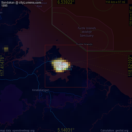
» NASA, Earths city lights 1995
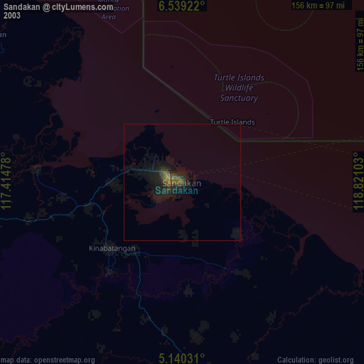
» NASA city lights 2003
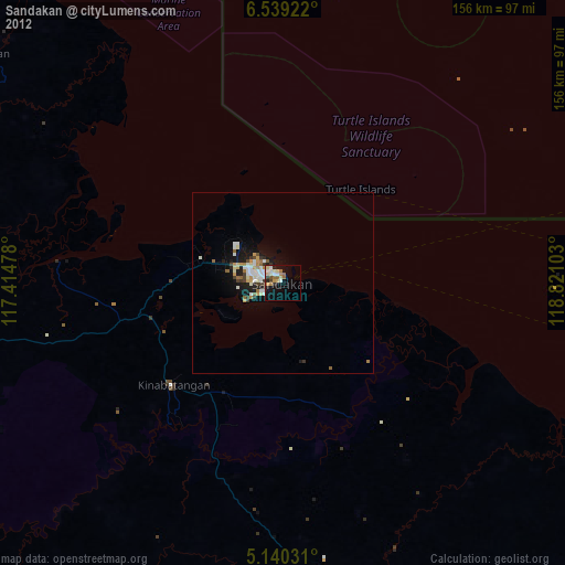
» Earth at Night: Flat Maps 2012, 2016