Seremban night lights from space
Night Light of Seremban (Negeri Sembilan) from space (Malaysia) Src. Average luminocity for 10x10km area is 88.645% and for 50x50km: 38.6493%.
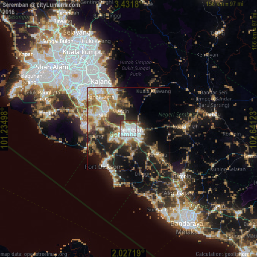
Analysis of Seremban night lights 2016
Square area 10x10 km:
 51.3%
51.3%90-99
23.16%80-89
3.68%70-79
3.9%60-69
5.41%50-59
1.08%40-49
7.14%30-39
3.46%20-29
0.87%10-19
0%0-9
0%Square area 50x50 km:
7.59%90-99
7.14%80-89
3.49%70-79
4.85%60-69
7.1%50-59
5.51%40-49
6.14%30-39
5.45%20-29
10.13%10-19
15.2%0-9
27.41%Clear (daylight) street map image can be seen on geolist.org.
Map coordinates:
3° 25' 54.5" North, 101° 14' 5.9" East
2° 43' 46.9" North, 101° 56' 17.2" East
2° 1' 37.9" North, 102° 38' 28.4" East
Some cities around Seremban sort by population:
• Sepang
21.3 km =13.2 mi,  258°
258°
• Semenyih
26.8 km =16.7 mi,  336°
336°
• Port Dickson
26 km =16.2 mi,  214°
214°
• Kampong Baharu Balakong
39.7 km =24.7 mi,  328°
328°
• Putrajaya
35.7 km =22.2 mi,  309°
309°
• Kampung Baharu Nilai
17.7 km =11 mi,  297°
297°
• Kuala Pilah
34.5 km =21.4 mi,  88°
88°
• Sungai Pelek New Village
27.9 km =17.3 mi,  251°
251°
1734810 (p: 372,917)
Sources (retrieved 2019-11-25):
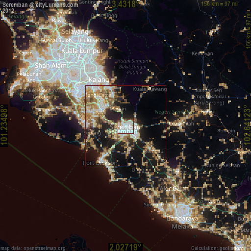
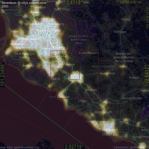
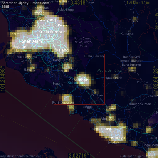
» NASA, Earths city lights 1995
» NASA city lights 2003
» Earth at Night: Flat Maps 2012, 2016