Kuala Pilah night lights from space
Night Light of Kuala Pilah (Negeri Sembilan) from space (Malaysia) Src. Average luminocity for 10x10km area is 38.0195% and for 50x50km: 12.6675%.
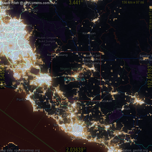
Analysis of Kuala Pilah night lights 2016
Square area 10x10 km:
 1.08%
1.08%90-99
3.68%80-89
1.73%70-79
8.44%60-69
7.58%50-59
12.99%40-49
10.17%30-39
3.46%20-29
8.87%10-19
38.53%0-9
3.46%Square area 50x50 km:
0.31%90-99
0.54%80-89
0.7%70-79
1.27%60-69
2.84%50-59
2.93%40-49
3.32%30-39
2.78%20-29
4.28%10-19
13.14%0-9
67.89%Clear (daylight) street map image can be seen on geolist.org.
Map coordinates:
3° 26' 27.6" North, 101° 32' 44.1" East
2° 44' 20" North, 102° 14' 55.3" East
2° 2' 11" North, 102° 57' 6.6" East
Some cities around Kuala Pilah sort by population:
• Seremban
34.5 km =21.4 mi,  268°
268°
• Semenyih
50.9 km =31.6 mi,  297°
297°
• Kampung Baharu Nilai
50.7 km =31.5 mi,  278°
278°
• Bahau
19 km =11.8 mi,  66°
66°
• Kampong Masjid Tanah
45.7 km =28.4 mi,  198°
198°
• Tampin
30 km =18.6 mi,  183°
183°
• Alor Gajah
40.1 km =24.9 mi,  186°
186°
• Pulau Sebang
31.6 km =19.6 mi, 183°
1734841 (p: 19,510)
Sources (retrieved 2019-11-25):
» Earth at Night: Flat Maps 2012, 2016