Padang Mat Sirat night lights from space
Night Light of Padang Mat Sirat (Kedah) from space (Malaysia) Src. Average luminocity for 10x10km area is 32.1126% and for 50x50km: 4.4381%.
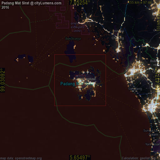
Analysis of Padang Mat Sirat night lights 2016
Square area 10x10 km:
 2.6%
2.6%90-99
1.95%80-89
6.28%70-79
3.68%60-69
5.84%50-59
6.06%40-49
6.06%30-39
7.79%20-29
6.93%10-19
34.2%0-9
18.61%Square area 50x50 km:
0.33%90-99
0.46%80-89
0.47%70-79
0.32%60-69
0.56%50-59
0.99%40-49
1.35%30-39
0.59%20-29
0.74%10-19
4.56%0-9
89.63%Clear (daylight) street map image can be seen on geolist.org.
Map coordinates:
7° 3' 9.1" North, 99° 1' 51.3" East
6° 21' 15.2" North, 99° 44' 2.5" East
5° 39' 17.9" North, 100° 26' 13.8" East
Some cities around Padang Mat Sirat sort by population:
• Alor Setar
73.9 km =45.9 mi,  110°
110°
• Kangar
52.2 km =32.4 mi,  79°
79°
• Satun, TH
47.4 km =29.5 mi,  50°
50°
• Kuah
12.5 km =7.8 mi,  104°
104°
• Kuala Kedah
68.6 km =42.6 mi, 114°
• Pantai Cenang
6.8 km =4.2 mi,  185°
185°
• Kuala Perlis
44.4 km =27.6 mi, 83°
• Ayer Hangat
12.2 km =7.6 mi, 52°
1222387 (p: 10,000)
Sources (retrieved 2019-11-25):
» Earth at Night: Flat Maps 2012, 2016