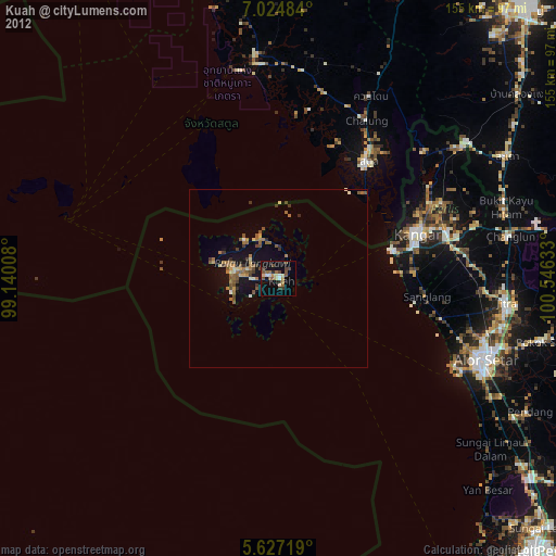
Kuah night lights from space
Night Light of Kuah (Kedah) from space (Malaysia) Src. Average luminocity for 10x10km area is 28.8506% and for 50x50km: 4.5494%.
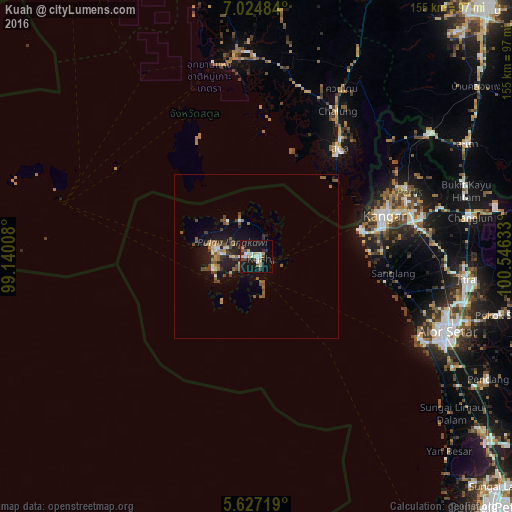
Analysis of Kuah night lights 2016
Square area 10x10 km:
 3.68%
3.68%90-99
6.71%80-89
3.46%70-79
2.81%60-69
1.95%50-59
2.81%40-49
6.06%30-39
1.08%20-29
1.95%10-19
43.07%0-9
26.41%Square area 50x50 km:
0.33%90-99
0.46%80-89
0.47%70-79
0.32%60-69
0.6%50-59
1.11%40-49
1.37%30-39
0.59%20-29
0.74%10-19
4.6%0-9
89.43%Clear (daylight) street map image can be seen on geolist.org.
Map coordinates:
7° 1' 29.4" North, 99° 8' 24.3" East
6° 19' 35.4" North, 99° 50' 35.5" East
5° 37' 37.9" North, 100° 32' 46.8" East
Some cities around Kuah sort by population:
• Alor Setar
61.5 km =38.2 mi,  111°
111°
• Kangar
41.3 km =25.7 mi,  71°
71°
• Satun, TH
41.2 km =25.6 mi,  36°
36°
• Kuala Kedah
56.4 km =35 mi,  116°
116°
• Pantai Cenang
13.3 km =8.3 mi,  254°
254°
• Kuala Perlis
33.1 km =20.6 mi,  75°
75°
• Padang Mat Sirat
12.5 km =7.8 mi,  284°
284°
• Ayer Hangat
10.7 km =6.6 mi,  347°
347°
1222396 (p: 30,212)
Sources (retrieved 2019-11-25):
» Earth at Night: Flat Maps 2012, 2016