Labis night lights from space
Night Light of Labis (Johor) from space (Malaysia) Src. Average luminocity for 10x10km area is 9.8139% and for 50x50km: 4.4284%.
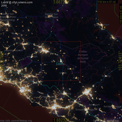
Analysis of Labis night lights 2016
Square area 10x10 km:
 1.08%
1.08%90-99
2.38%80-89
0%70-79
2.6%60-69
1.52%50-59
1.73%40-49
0.22%30-39
0%20-29
0.87%10-19
0.65%0-9
88.96%Square area 50x50 km:
0.42%90-99
0.43%80-89
0.22%70-79
1.12%60-69
0.84%50-59
0.57%40-49
0.71%30-39
0.63%20-29
1.06%10-19
2.49%0-9
91.49%Clear (daylight) street map image can be seen on geolist.org.
Map coordinates:
3° 5' 14.4" North, 102° 19' 4.4" East
2° 23' 6" North, 103° 1' 15.6" East
1° 40' 56.4" North, 103° 43' 26.9" East
Some cities around Labis sort by population:
• Kluang
51.3 km =31.9 mi,  140°
140°
• Segamat
27 km =16.8 mi,  302°
302°
• Tangkak
54.4 km =33.8 mi,  256°
256°
• Bakri
55.8 km =34.7 mi,  227°
227°
• Yong Peng
41.6 km =25.8 mi,  173°
173°
• Parit Raja
58.4 km =36.3 mi, 169°
• Buloh Kasap
34.2 km =21.3 mi, 303°
• Chaah
15.4 km =9.6 mi, 168°
1732877 (p: 21,906)
Sources (retrieved 2019-11-25):
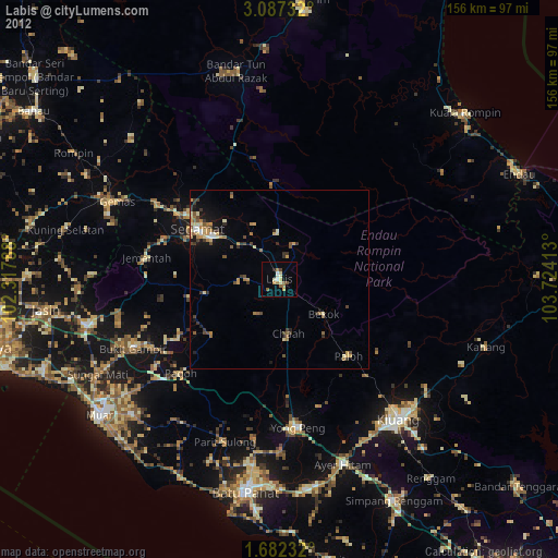
» Earth at Night: Flat Maps 2012, 2016