Bakri night lights from space
Night Light of Bakri (Johor) from space (Malaysia) Src. Average luminocity for 10x10km area is 43.5022% and for 50x50km: 17.1966%.
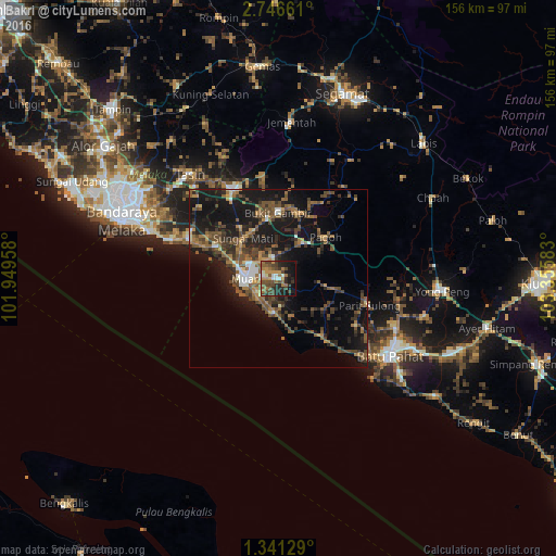
Analysis of Bakri night lights 2016
Square area 10x10 km:
 2.81%
2.81%90-99
4.98%80-89
1.08%70-79
9.74%60-69
9.96%50-59
10.61%40-49
16.23%30-39
5.19%20-29
14.72%10-19
19.91%0-9
4.76%Square area 50x50 km:
0.98%90-99
1.36%80-89
0.66%70-79
1.96%60-69
3.1%50-59
4.61%40-49
5.4%30-39
3.15%20-29
5.23%10-19
18.14%0-9
55.42%Clear (daylight) street map image can be seen on geolist.org.
Map coordinates:
2° 44' 47.8" North, 101° 56' 58.5" East
2° 2' 38.8" North, 102° 39' 9.7" East
1° 20' 28.6" North, 103° 21' 21" East
Some cities around Bakri sort by population:
• Batu Pahat
37.5 km =23.3 mi,  124°
124°
• Muar
9.3 km =5.8 mi,  270°
270°
• Kampung Bukit Baharu
45.1 km =28 mi,  294°
294°
• Kampung Ayer Keroh
48.2 km =30 mi,  300°
300°
• Tangkak
27.5 km =17.1 mi,  334°
334°
• Yong Peng
46 km =28.6 mi,  94°
94°
• Kampung Ayer Molek
40.7 km =25.3 mi, 297°
• Bemban
39.7 km =24.7 mi,  308°
308°
1732871 (p: 30,280)
Sources (retrieved 2019-11-25):
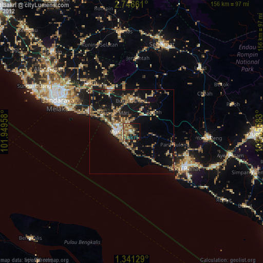
» Earth at Night: Flat Maps 2012, 2016