Alor Gajah night lights from space
Night Light of Alor Gajah (Melaka) from space (Malaysia) Src. Average luminocity for 10x10km area is 63.7078% and for 50x50km: 33.8759%.
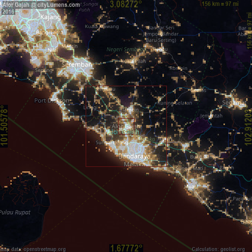
Analysis of Alor Gajah night lights 2016
Square area 10x10 km:
 8.23%
8.23%90-99
14.29%80-89
6.93%70-79
7.58%60-69
12.12%50-59
18.18%40-49
17.1%30-39
12.55%20-29
3.03%10-19
0%0-9
0%Square area 50x50 km:
5.56%90-99
4.92%80-89
3.04%70-79
3.86%60-69
5.88%50-59
6.54%40-49
6.1%30-39
5.49%20-29
10.19%10-19
18.88%0-9
29.54%Clear (daylight) street map image can be seen on geolist.org.
Map coordinates:
3° 4' 57.8" North, 101° 30' 20.8" East
2° 22' 49.4" North, 102° 12' 32" East
1° 40' 39.8" North, 102° 54' 43.3" East
Some cities around Alor Gajah sort by population:
• Klebang Besar
18 km =11.2 mi,  183°
183°
• Kampung Ayer Keroh
15 km =9.3 mi,  148°
148°
• Kampong Masjid Tanah
10.8 km =6.7 mi,  251°
251°
• Tampin
10.3 km =6.4 mi,  13°
13°
• Sungai Udang
14.4 km =8.9 mi,  210°
210°
• Batu Berendam
15.2 km =9.4 mi,  164°
164°
• Bukit Rambai
13.7 km =8.5 mi,  191°
191°
• Pulau Sebang
8.7 km =5.4 mi,  17°
17°
1734745 (p: 20,163)
Sources (retrieved 2019-11-25):
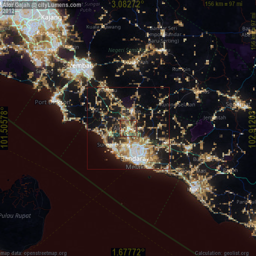
» Earth at Night: Flat Maps 2012, 2016