Kota Kinabalu night lights from space
Night Light of Kota Kinabalu (Sabah) from space (Malaysia) Src. Average luminocity for 10x10km area is 61.5083% and for 50x50km: 11.9397%.
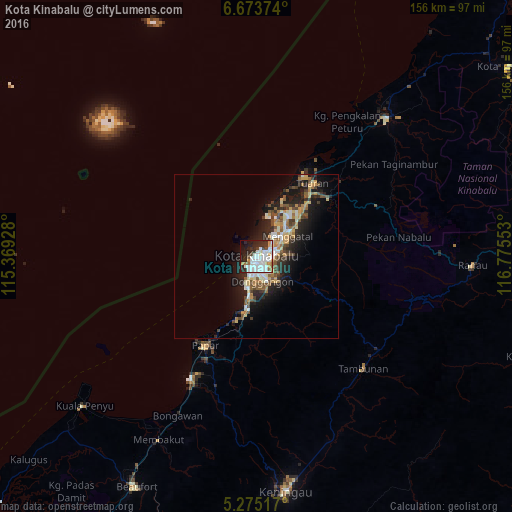

Analysis of Kota Kinabalu night lights 2016
Square area 10x10 km:
 26.65%
90-99
15.5%80-89
3.1%70-79
5.79%60-69
1.65%50-59
2.69%40-49
3.1%30-39
7.02%20-29
18.39%10-19
12.4%0-9
3.72%Square area 50x50 km:
1.82%90-99
2.07%80-89
1.2%70-79
1.54%60-69
1.44%50-59
1.68%40-49
1.78%30-39
1.63%20-29
4.3%10-19
7.84%0-9
74.7%Clear (daylight) street map image can be seen on geolist.org.
Map coordinates:
6° 40' 25.5" North, 115° 22' 9.4" East
5° 58' 29.6" North, 116° 4' 20.6" East
5° 16' 30.6" North, 116° 46' 31.9" East
Some cities around Kota Kinabalu sort by population:
• Putatan
5.6 km =3.5 mi,  193°
193°
• Keningau
71.5 km =44.4 mi,  172°
172°
• Donggongon
8.2 km =5.1 mi,  156°
156°
• Bandar Labuan
117.1 km =72.8 mi,  229°
229°
• Ranau
65.5 km =40.7 mi,  92°
92°
• Papar
31 km =19.3 mi,  209°
209°
• Beaufort
78.6 km =48.8 mi, 207°
• Kinarut
17.1 km =10.6 mi, 189°
1733432 (p: 457,326)
Sources (retrieved 2019-11-25):
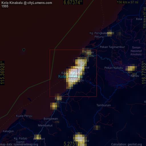
» NASA, Earths city lights 1995
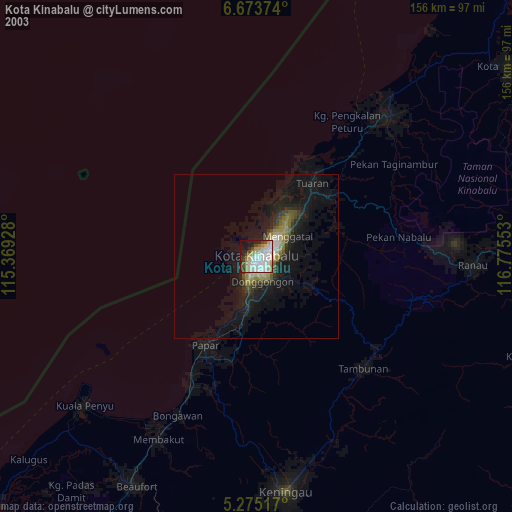
» NASA city lights 2003
» Earth at Night: Flat Maps 2012, 2016