Beaufort night lights from space
Night Light of Beaufort (Sabah) from space (Malaysia) Src. Average luminocity for 10x10km area is 10.1095% and for 50x50km: 0.6537%.
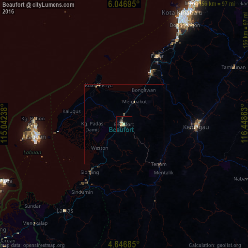
Analysis of Beaufort night lights 2016
Square area 10x10 km:
 0%
0%90-99
2.89%80-89
2.27%70-79
0.62%60-69
0.83%50-59
0%40-49
3.1%30-39
1.86%20-29
2.48%10-19
0.83%0-9
85.12%Square area 50x50 km:
0%90-99
0.15%80-89
0.1%70-79
0.07%60-69
0.05%50-59
0.07%40-49
0.14%30-39
0.15%20-29
0.27%10-19
0.09%0-9
98.9%Clear (daylight) street map image can be seen on geolist.org.
Map coordinates:
6° 2' 49" North, 115° 2' 32.6" East
5° 20' 50.3" North, 115° 44' 43.8" East
4° 38' 48.7" North, 116° 26' 55.1" East
Some cities around Beaufort sort by population:
• Putatan
73.2 km =45.5 mi,  28°
28°
• Keningau
45.9 km =28.5 mi,  91°
91°
• Labuan
55.6 km =34.5 mi,  262°
262°
• Donggongon
73.7 km =45.8 mi, 32°
• Bandar Labuan
53.1 km =33 mi, 262°
• Lawas
65.7 km =40.8 mi,  214°
214°
• Papar
47.7 km =29.6 mi, 25°
• Kinarut
62.5 km =38.8 mi, 32°
1733874 (p: 15,855)
Sources (retrieved 2019-11-25):
» Earth at Night: Flat Maps 2012, 2016