Donggongon night lights from space
Night Light of Donggongon (Sabah) from space (Malaysia) Src. Average luminocity for 10x10km area is 53.3905% and for 50x50km: 11.0274%.
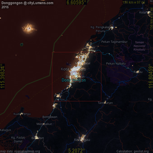
Analysis of Donggongon night lights 2016
Square area 10x10 km:
 14.26%
90-99
9.71%80-89
5.79%70-79
3.1%60-69
8.47%50-59
10.74%40-49
8.88%30-39
3.31%20-29
16.74%10-19
13.02%0-9
5.99%Square area 50x50 km:
1.82%90-99
2.04%80-89
1.05%70-79
1.41%60-69
1.23%50-59
1.53%40-49
1.69%30-39
1.5%20-29
3.9%10-19
6.4%0-9
77.43%Clear (daylight) street map image can be seen on geolist.org.
Map coordinates:
6° 36' 21.4" North, 115° 23' 54" East
5° 54' 25.3" North, 116° 6' 5.3" East
5° 12' 25.9" North, 116° 48' 16.5" East
Some cities around Donggongon sort by population:
• Kota Kinabalu
8.2 km =5.1 mi,  336°
336°
• Putatan
4.9 km =3 mi,  294°
294°
• Keningau
63.6 km =39.5 mi,  174°
174°
• Ranau
62.4 km =38.8 mi,  85°
85°
• Papar
26.8 km =16.7 mi,  223°
223°
• Beaufort
73.7 km =45.8 mi,  212°
212°
• Kinarut
11.1 km =6.9 mi, 213°
• Kota Belud
61.3 km =38.1 mi,  36°
36°
1733438 (p: 71,585)
Sources (retrieved 2019-11-25):
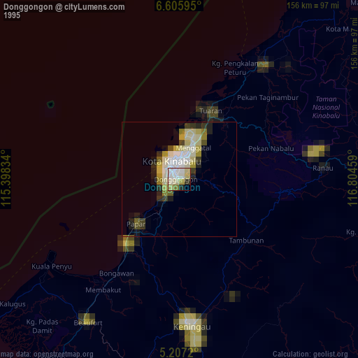
» NASA, Earths city lights 1995
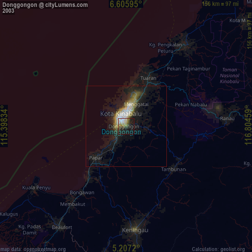
» NASA city lights 2003
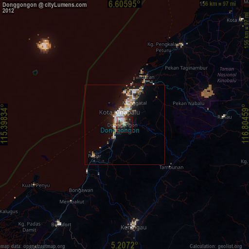
» Earth at Night: Flat Maps 2012, 2016