Kinarut night lights from space
Night Light of Kinarut (Sabah) from space (Malaysia) Src. Average luminocity for 10x10km area is 18.2376% and for 50x50km: 8.6794%.
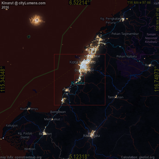
Analysis of Kinarut night lights 2016
Square area 10x10 km:
 0%
0%90-99
2.69%80-89
1.45%70-79
3.31%60-69
1.45%50-59
2.89%40-49
7.02%30-39
1.86%20-29
2.89%10-19
19.21%0-9
57.23%Square area 50x50 km:
1.67%90-99
1.56%80-89
0.73%70-79
1.04%60-69
0.93%50-59
0.99%40-49
1.35%30-39
1.13%20-29
3.13%10-19
4.68%0-9
82.78%Clear (daylight) street map image can be seen on geolist.org.
Map coordinates:
6° 31' 19.7" North, 115° 20' 36.5" East
5° 49' 23.2" North, 116° 2' 47.8" East
5° 7' 23.4" North, 116° 44' 59" East
Some cities around Kinarut sort by population:
• Kota Kinabalu
17.1 km =10.6 mi,  9°
9°
• Putatan
11.5 km =7.1 mi, 7°
• Keningau
55.4 km =34.4 mi,  166°
166°
• Donggongon
11.1 km =6.9 mi,  33°
33°
• Ranau
69.8 km =43.4 mi,  77°
77°
• Papar
16 km =9.9 mi,  231°
231°
• Beaufort
62.5 km =38.8 mi,  212°
212°
• Kota Belud
72.4 km =45 mi,  35°
35°
1733449 (p: 15,716)
Sources (retrieved 2019-11-25):
» Earth at Night: Flat Maps 2012, 2016