Villa Mariano Matamoros night lights from space
Night Light of Villa Mariano Matamoros (Puebla) from space (Mexico) Src. Average luminocity for 10x10km area is 46.3099% and for 50x50km: 37.8755%.
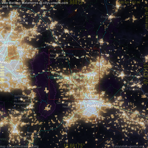
Analysis of Villa Mariano Matamoros night lights 2016
Square area 10x10 km:
 0.21%
0.21%90-99
0.41%80-89
15.7%70-79
5.58%60-69
13.64%50-59
6.82%40-49
16.53%30-39
7.02%20-29
13.84%10-19
18.39%0-9
1.86%Square area 50x50 km:
2.37%90-99
4.13%80-89
11.34%70-79
7.98%60-69
6.81%50-59
5.82%40-49
7.15%30-39
4.51%20-29
5.37%10-19
8.4%0-9
36.14%Clear (daylight) street map image can be seen on geolist.org.
Map coordinates:
19° 59' 19.4" North, 99° 4' 53" West
19° 19' 35.7" North, 98° 22' 41.8" West
18° 39' 42.3" North, 97° 40' 30.5" West
Some cities around Villa Mariano Matamoros sort by population:
• San Martin Texmelucan de Labastida
7.9 km =4.9 mi,  233°
233°
• Moyotzingo
9.2 km =5.7 mi,  197°
197°
• San Rafael Tlanalapan
10.2 km =6.3 mi,  247°
247°
• San Lucas el Grande
10.8 km =6.7 mi,  257°
257°
• Tepetitla
6.8 km =4.2 mi,  178°
178°
• Santa Ana Nopalucan
5.7 km =3.5 mi,  123°
123°
• San Juan Tuxco
10.7 km =6.6 mi, 225°
• San Damián Texoloc
11.1 km =6.9 mi, 118°
3519410 (p: 6,527)
Sources (retrieved 2019-11-25):
» Earth at Night: Flat Maps 2012, 2016