Villa Juárez night lights from space
Night Light of Villa Juárez (Sonora) from space (Mexico) Src. Average luminocity for 10x10km area is 6.8295% and for 50x50km: 1.2887%.
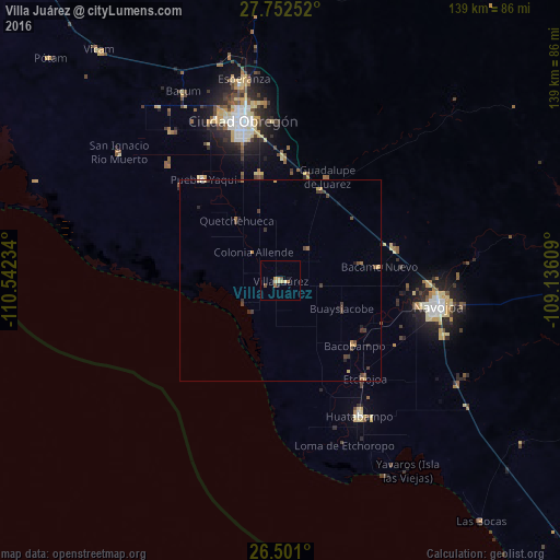
Analysis of Villa Juárez night lights 2016
Square area 10x10 km:
 0%
0%90-99
0.19%80-89
2.08%70-79
2.27%60-69
1.33%50-59
0.19%40-49
1.52%30-39
0%20-29
0.76%10-19
0.76%0-9
90.91%Square area 50x50 km:
0%90-99
0.04%80-89
0.18%70-79
0.32%60-69
0.23%50-59
0.05%40-49
0.47%30-39
0.44%20-29
0.24%10-19
0.14%0-9
97.88%Clear (daylight) street map image can be seen on geolist.org.
Map coordinates:
27° 45' 9.1" North, 110° 32' 32.4" West
27° 7' 42.6" North, 109° 50' 21.2" West
26° 30' 3.6" North, 109° 8' 9.9" West
Some cities around Villa Juárez sort by population:
• Ciudad Obregón
41 km =25.5 mi,  345°
345°
• Navojoa
39.7 km =24.7 mi,  99°
99°
• Huatabampo
38.9 km =24.2 mi,  149°
149°
• Pueblo Yaqui
31.7 km =19.7 mi,  322°
322°
• Etchojoa
32.1 km =19.9 mi,  138°
138°
• El Tobarito
27.4 km =17 mi, 348°
• Marte R. Gómez (Tobarito)
27 km =16.8 mi, 350°
• Bacobampo
24.5 km =15.2 mi,  131°
131°
3980161 (p: 13,770)
Sources (retrieved 2019-11-25):
» Earth at Night: Flat Maps 2012, 2016