Etchojoa night lights from space
Night Light of Etchojoa (Sonora) from space (Mexico) Src. Average luminocity for 10x10km area is 5.0278% and for 50x50km: 4.7591%.
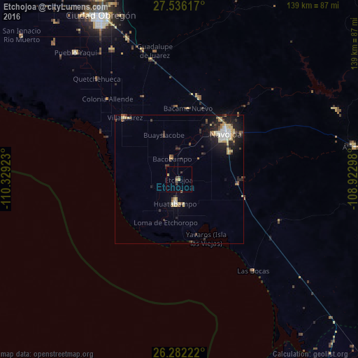
Analysis of Etchojoa night lights 2016
Square area 10x10 km:
 0%
0%90-99
0%80-89
0.79%70-79
0.79%60-69
0.79%50-59
0.4%40-49
2.38%30-39
1.59%20-29
0.4%10-19
0%0-9
92.86%Square area 50x50 km:
0.44%90-99
0.64%80-89
0.9%70-79
0.75%60-69
0.47%50-59
0.34%40-49
0.74%30-39
0.65%20-29
1.63%10-19
2.93%0-9
90.49%Clear (daylight) street map image can be seen on geolist.org.
Map coordinates:
27° 32' 10.2" North, 110° 19' 45.2" West
26° 54' 39.4" North, 109° 37' 34" West
26° 16' 56" North, 108° 55' 22.7" West
Some cities around Etchojoa sort by population:
• Navojoa
25.3 km =15.7 mi,  45°
45°
• Huatabampo
9.6 km =6 mi,  189°
189°
• Pueblo Yaqui
63.8 km =39.6 mi,  320°
320°
• Villa Juárez
32.1 km =19.9 mi, 318°
• Álamos
69.7 km =43.3 mi,  79°
79°
• El Tobarito
57.6 km =35.8 mi,  332°
332°
• Marte R. Gómez (Tobarito)
56.9 km =35.4 mi, 333°
• Bacobampo
8.4 km =5.2 mi,  341°
341°
4006388 (p: 9,710)
Sources (retrieved 2019-11-25):
» Earth at Night: Flat Maps 2012, 2016