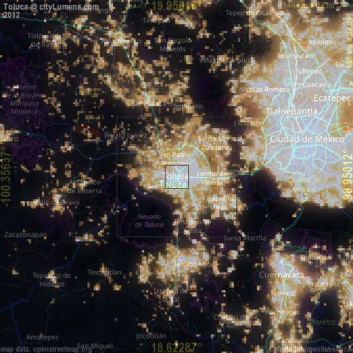
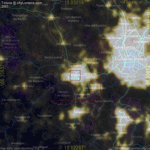
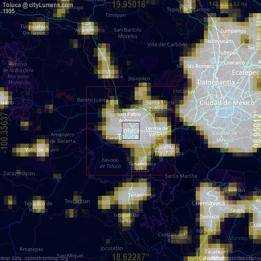
Toluca night lights from space
Night Light of Toluca (México) from space (Mexico) Src. Average luminocity for 10x10km area is 94.513% and for 50x50km: 38.985%.
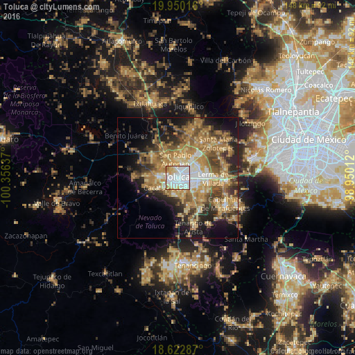
Analysis of Toluca night lights 2016
Square area 10x10 km:
 51.73%
90-99
25.76%80-89
11.26%70-79
8.01%60-69
3.03%50-59
0.22%40-49
0%30-39
0%20-29
0%10-19
0%0-9
0%Square area 50x50 km:
4.26%90-99
4.27%80-89
6.56%70-79
8.29%60-69
11.28%50-59
5.44%40-49
6.25%30-39
4.91%20-29
8.03%10-19
10.84%0-9
29.87%Clear (daylight) street map image can be seen on geolist.org.
Map coordinates:
19° 57' 0.6" North, 100° 21' 22.9" West
19° 17' 16.3" North, 99° 39' 11.7" West
18° 37' 22.3" North, 98° 57' 0.4" West
Some cities around Toluca sort by population:
• Metepec
6.3 km =3.9 mi,  120°
120°
• San Jerónimo Chicahualco
6.4 km =4 mi,  95°
95°
• San Francisco Cuaxusco
4.2 km =2.6 mi, 122°
• San Jorge Pueblo Nuevo
4.6 km =2.9 mi,  144°
144°
• San Buenaventura
3.2 km =2 mi,  220°
220°
• San Felipe Tlalmimilolpan
5.5 km =3.4 mi,  167°
167°
• Santa María Magdalena Ocotitlán
6.4 km =4 mi,  151°
151°
• San Marcos Yachihuacaltepec
4.8 km =3 mi,  325°
325°
3515302 (p: 489,333)
Sources (retrieved 2019-11-25):
» NASA, Earths city lights 1995
» NASA city lights 2003
» Earth at Night: Flat Maps 2012, 2016