Tizayuca night lights from space
Night Light of Tizayuca (Hidalgo) from space (Mexico) Src. Average luminocity for 10x10km area is 75.6667% and for 50x50km: 50.4934%.
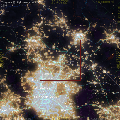
Analysis of Tizayuca night lights 2016
Square area 10x10 km:
 15.37%
90-99
18.61%80-89
11.47%70-79
14.94%60-69
17.97%50-59
9.09%40-49
5.84%30-39
3.25%20-29
3.46%10-19
0%0-9
0%Square area 50x50 km:
9.25%90-99
7.87%80-89
9.44%70-79
9.82%60-69
9.39%50-59
5.76%40-49
6.12%30-39
4.71%20-29
8.29%10-19
15.13%0-9
14.22%Clear (daylight) street map image can be seen on geolist.org.
Map coordinates:
20° 29' 50" North, 99° 40' 45.1" West
19° 50' 14" North, 98° 58' 33.9" West
19° 10' 28" North, 98° 16' 22.6" West
Some cities around Tizayuca sort by population:
• Reyes Acozac
6.9 km =4.3 mi,  184°
184°
• Santa María Ajoloapan
8.4 km =5.2 mi,  167°
167°
• Don Antonio
6 km =3.7 mi,  46°
46°
• San Bartolo Cuautlalpan
4.4 km =2.7 mi,  235°
235°
• Paseos de San Juan
7.5 km =4.7 mi,  215°
215°
• Temascalapa
7.8 km =4.8 mi,  97°
97°
• Arbolada los Sauces
7.5 km =4.7 mi,  251°
251°
• Huitzila
3.6 km =2.2 mi,  143°
143°
3515505 (p: 43,250)
Sources (retrieved 2019-11-25):
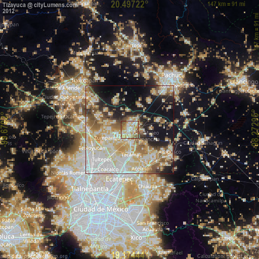
» Earth at Night: Flat Maps 2012, 2016