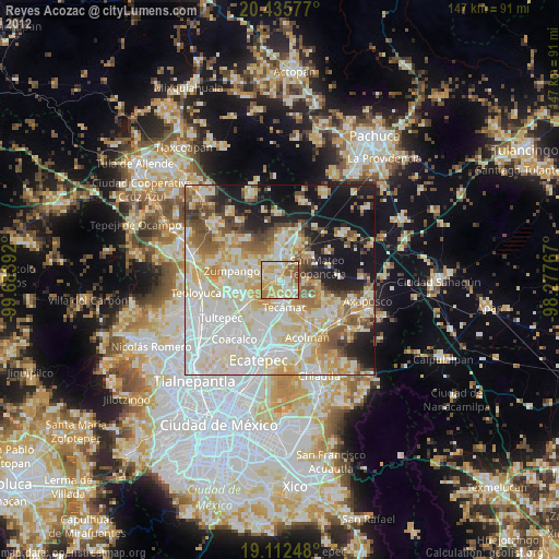
Reyes Acozac night lights from space
Night Light of Reyes Acozac (Morelos) from space (Mexico) Src. Average luminocity for 10x10km area is 73.9566% and for 50x50km: 58.2506%.

Analysis of Reyes Acozac night lights 2016
Square area 10x10 km:
 7.44%
7.44%90-99
15.5%80-89
13.22%70-79
16.94%60-69
26.65%50-59
14.46%40-49
5.79%30-39
0%20-29
0%10-19
0%0-9
0%Square area 50x50 km:
12.69%90-99
10.01%80-89
12.11%70-79
11.16%60-69
9.34%50-59
5.38%40-49
5.51%30-39
4.42%20-29
8.2%10-19
13.69%0-9
7.49%Clear (daylight) street map image can be seen on geolist.org.
Map coordinates:
20° 26' 8.8" North, 99° 41' 2.1" West
19° 46' 31.8" North, 98° 58' 50.8" West
19° 6' 44.9" North, 98° 16' 39.6" West
Some cities around Reyes Acozac sort by population:
• Tizayuca
6.9 km =4.3 mi,  4°
4°
• Santa María Ajoloapan
2.6 km =1.6 mi,  120°
120°
• Tecámac de Felipe Villanueva
7.1 km =4.4 mi,  169°
169°
• Tecámac
7.1 km =4.4 mi, 169°
• San Bartolo Cuautlalpan
5.4 km =3.4 mi,  324°
324°
• Paseos de San Juan
3.9 km =2.4 mi,  280°
280°
• Santa Ana Tlachiahualpa
7.6 km =4.7 mi,  95°
95°
• Huitzila
4.8 km =3 mi,  33°
33°
3523900 (p: 21,910)
Sources (retrieved 2019-11-25):
» Earth at Night: Flat Maps 2012, 2016