Tijuana night lights from space
Night Light of Tijuana (Baja California) from space (Mexico) Src. Average luminocity for 10x10km area is 96.1429% and for 50x50km: 34.6341%.
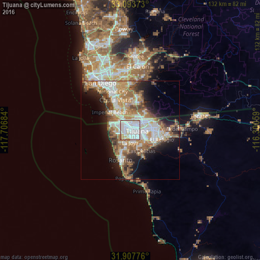
Analysis of Tijuana night lights 2016
Square area 10x10 km:
 51.83%
90-99
34.98%80-89
4.03%70-79
7.14%60-69
1.83%50-59
0.18%40-49
0%30-39
0%20-29
0%10-19
0%0-9
0%Square area 50x50 km:
7.61%90-99
7.79%80-89
3.06%70-79
4.8%60-69
7.69%50-59
4.67%40-49
3.86%30-39
2.87%20-29
4.92%10-19
9.44%0-9
43.29%Clear (daylight) street map image can be seen on geolist.org.
Map coordinates:
33° 5' 37.4" North, 117° 42' 24.6" West
32° 30' 9.7" North, 117° 0' 13.4" West
31° 54' 27.9" North, 116° 18' 2.1" West
Fantastic image of Tijuana from space taken by astronauts [src2], but I don't have information about it's orientation, scale or angle. If necessary, it was rotated manually, so North points approximately to upper direction. Click to zoom in:

Some cities around Tijuana sort by population:
• Rosarito
16.3 km =10.1 mi,  194°
194°
• Pórticos de San Antonio
7.3 km =4.5 mi,  203°
203°
• Imperial Beach, US
13.7 km =8.5 mi,  311°
311°
• Rancho La Gloria
6.3 km =3.9 mi,  177°
177°
• Villa del Prado 2da Sección
9.3 km =5.8 mi,  161°
161°
• Las Delicias
11.9 km =7.4 mi,  151°
151°
• San Luis
9.2 km =5.7 mi, 149°
• Quinta del Cedro
9.3 km =5.8 mi,  218°
218°
3981609 (p: 1,300,983)
Sources (retrieved 2019-11-25):
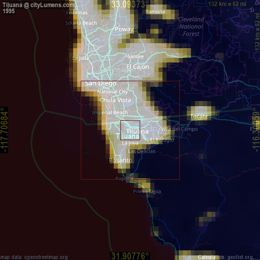
» NASA, Earths city lights 1995
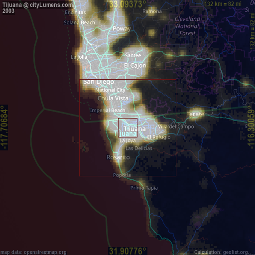
» NASA city lights 2003
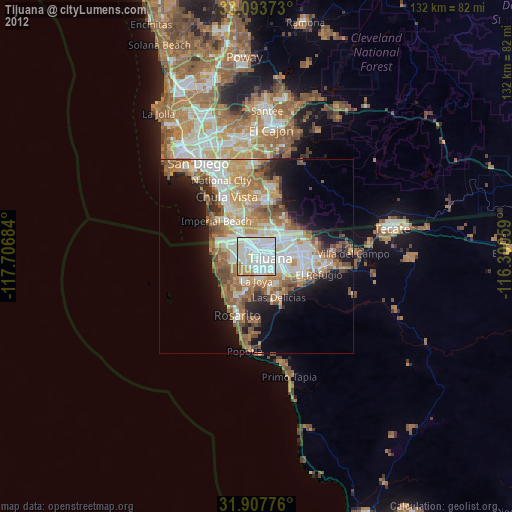
» Earth at Night: Flat Maps 2012, 2016
Src.2: Reid Wiseman @astro_reid 2014