Rancho La Gloria night lights from space
Night Light of Rancho La Gloria (Baja California) from space (Mexico) Src. Average luminocity for 10x10km area is 82.0806% and for 50x50km: 30.1503%.
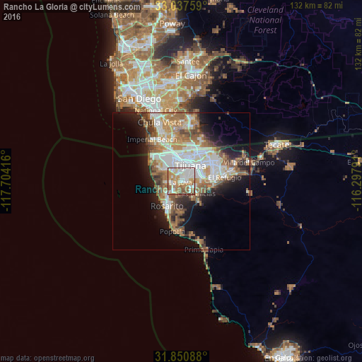
Analysis of Rancho La Gloria night lights 2016
Square area 10x10 km:
 25.82%
90-99
18.68%80-89
10.44%70-79
15.57%60-69
18.5%50-59
7.69%40-49
2.56%30-39
0.73%20-29
0%10-19
0%0-9
0%Square area 50x50 km:
6.67%90-99
6.78%80-89
2.56%70-79
3.7%60-69
6.71%50-59
4.17%40-49
3.4%30-39
2.59%20-29
4.29%10-19
8.9%0-9
50.21%Clear (daylight) street map image can be seen on geolist.org.
Map coordinates:
33° 2' 15.3" North, 117° 42' 15" West
32° 26' 46.3" North, 117° 0' 3.7" West
31° 51' 3.2" North, 116° 17' 52.5" West
Some cities around Rancho La Gloria sort by population:
• Tijuana
6.3 km =3.9 mi,  357°
357°
• Rosarito
10.4 km =6.5 mi,  204°
204°
• Pórticos de San Antonio
3.1 km =1.9 mi,  262°
262°
• Terrazas del Valle
17 km =10.6 mi,  74°
74°
• Villa del Prado 2da Sección
3.7 km =2.3 mi,  131°
131°
• Las Delicias
6.8 km =4.2 mi, 127°
• San Luis
4.7 km =2.9 mi,  109°
109°
• Quinta del Cedro
6.2 km =3.9 mi, 260°
3990040 (p: 26,860)
Sources (retrieved 2019-11-25):
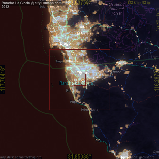
» Earth at Night: Flat Maps 2012, 2016