Rosarito night lights from space
Night Light of Rosarito (Baja California) from space (Mexico) Src. Average luminocity for 10x10km area is 50.793% and for 50x50km: 23.618%.
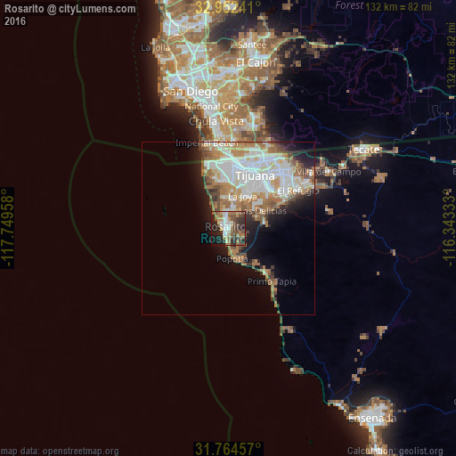
Analysis of Rosarito night lights 2016
Square area 10x10 km:
 8.06%
8.06%90-99
8.61%80-89
3.66%70-79
4.21%60-69
12.27%50-59
12.82%40-49
10.07%30-39
7.88%20-29
17.58%10-19
13.19%0-9
1.65%Square area 50x50 km:
5.83%90-99
5.8%80-89
1.91%70-79
2.36%60-69
5.08%50-59
2.96%40-49
2.45%30-39
1.71%20-29
3.06%10-19
6.3%0-9
62.54%Clear (daylight) street map image can be seen on geolist.org.
Map coordinates:
32° 57' 8.7" North, 117° 44' 58.5" West
32° 21' 37.6" North, 117° 2' 47.2" West
31° 45' 52.5" North, 116° 20' 36" West
Some cities around Rosarito sort by population:
• Tijuana
16.3 km =10.1 mi,  14°
14°
• Pórticos de San Antonio
9.2 km =5.7 mi, 7°
• Rancho La Gloria
10.4 km =6.5 mi,  24°
24°
• Terrazas del Valle
25 km =15.5 mi,  55°
55°
• Villa del Prado 2da Sección
10 km =6.2 mi,  44°
44°
• Las Delicias
11.1 km =6.9 mi, 60°
• San Luis
11.8 km =7.3 mi,  47°
47°
• Quinta del Cedro
8.8 km =5.5 mi,  348°
348°
3988392 (p: 65,278)
Sources (retrieved 2019-11-25):
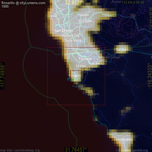
» NASA, Earths city lights 1995
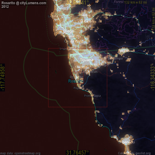
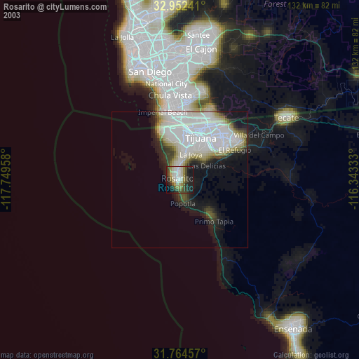
» NASA city lights 2003
» Earth at Night: Flat Maps 2012, 2016