Pórticos de San Antonio night lights from space
Night Light of Pórticos de San Antonio (Baja California) from space (Mexico) Src. Average luminocity for 10x10km area is 73.8077% and for 50x50km: 29.2193%.
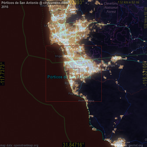
Analysis of Pórticos de San Antonio night lights 2016
Square area 10x10 km:
 13.55%
90-99
14.65%80-89
9.89%70-79
15.75%60-69
22.71%50-59
11.72%40-49
8.06%30-39
3.48%20-29
0.18%10-19
0%0-9
0%Square area 50x50 km:
6.62%90-99
6.7%80-89
2.51%70-79
3.62%60-69
6.43%50-59
3.89%40-49
3.26%30-39
2.37%20-29
3.95%10-19
8.18%0-9
52.46%Clear (daylight) street map image can be seen on geolist.org.
Map coordinates:
33° 2' 2.1" North, 117° 44' 14.3" West
32° 26' 33" North, 117° 2' 3" West
31° 50' 49.8" North, 116° 19' 51.8" West
Some cities around Pórticos de San Antonio sort by population:
• Tijuana
7.3 km =4.5 mi,  23°
23°
• Rosarito
9.2 km =5.7 mi,  187°
187°
• Imperial Beach, US
17.4 km =10.8 mi,  334°
334°
• Rancho La Gloria
3.1 km =1.9 mi,  82°
82°
• Villa del Prado 2da Sección
6.2 km =3.9 mi,  109°
109°
• Las Delicias
9.3 km =5.8 mi, 113°
• San Luis
7.7 km =4.8 mi,  99°
99°
• Quinta del Cedro
3 km =1.9 mi,  259°
259°
8858094 (p: 34,234)
Sources (retrieved 2019-11-25):
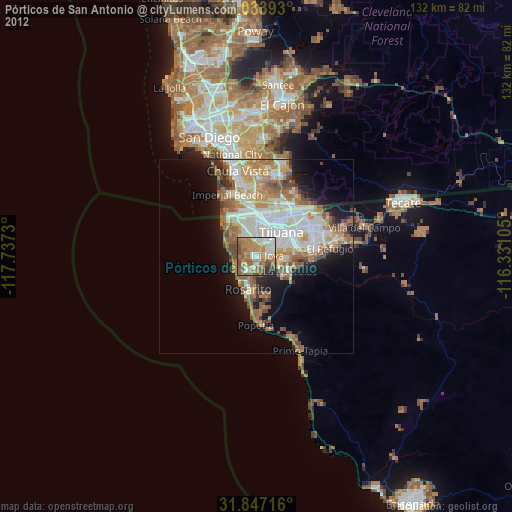
» Earth at Night: Flat Maps 2012, 2016