Temax night lights from space
Night Light of Temax (Yucatán) from space (Mexico) Src. Average luminocity for 10x10km area is 4.4583% and for 50x50km: 2.3044%.
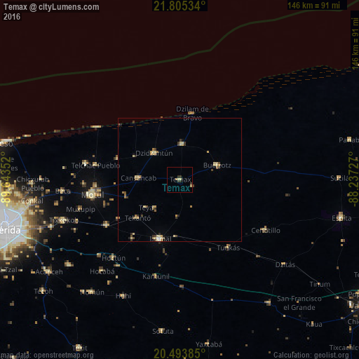
Analysis of Temax night lights 2016
Square area 10x10 km:
 0%
0%90-99
0%80-89
2.38%70-79
0%60-69
0.79%50-59
0%40-49
0.79%30-39
1.98%20-29
1.19%10-19
0.79%0-9
92.06%Square area 50x50 km:
0.04%90-99
0.09%80-89
0.86%70-79
0.31%60-69
0.4%50-59
0.13%40-49
0.47%30-39
0.48%20-29
0.25%10-19
0.28%0-9
96.68%Clear (daylight) street map image can be seen on geolist.org.
Map coordinates:
21° 48' 19.2" North, 89° 38' 36.7" West
21° 9' 3.8" North, 88° 56' 25.4" West
20° 29' 37.9" North, 88° 14' 14.2" West
Some cities around Temax sort by population:
• Motul
36.1 km =22.4 mi,  260°
260°
• Izamal
25.3 km =15.7 mi,  198°
198°
• Tixkokob
50 km =31.1 mi,  250°
250°
• Seyé
56.9 km =35.4 mi,  231°
231°
• Buctzotz
16.4 km =10.2 mi,  69°
69°
• Dzidzantun
15.2 km =9.4 mi,  315°
315°
• Cacalchen
35.1 km =21.8 mi,  237°
237°
• Dzilam González
14.5 km =9 mi,  4°
4°
3516048 (p: 6,239)
Sources (retrieved 2019-11-25):
» Earth at Night: Flat Maps 2012, 2016