Izamal night lights from space
Night Light of Izamal (Yucatán) from space (Mexico) Src. Average luminocity for 10x10km area is 12.5873% and for 50x50km: 3.0591%.
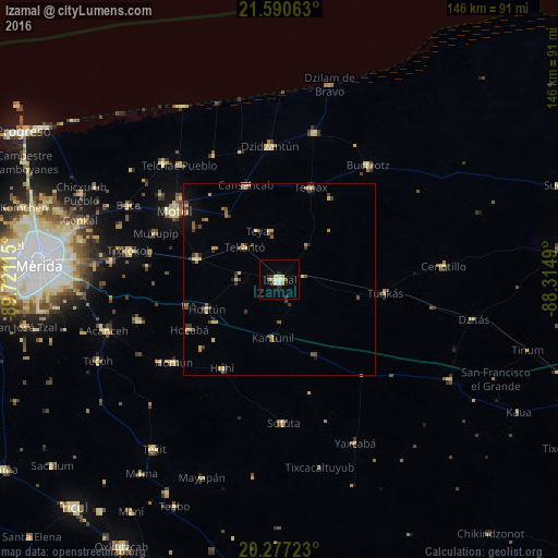
Analysis of Izamal night lights 2016
Square area 10x10 km:
 0.99%
0.99%90-99
1.39%80-89
3.97%70-79
1.59%60-69
0.4%50-59
0.4%40-49
2.18%30-39
0.99%20-29
1.98%10-19
1.59%0-9
84.52%Square area 50x50 km:
0.04%90-99
0.09%80-89
0.8%70-79
0.48%60-69
0.47%50-59
0.36%40-49
0.73%30-39
0.56%20-29
0.5%10-19
0.71%0-9
95.26%Clear (daylight) street map image can be seen on geolist.org.
Map coordinates:
21° 35' 26.3" North, 89° 43' 16.1" West
20° 56' 7.3" North, 89° 1' 4.9" West
20° 16' 38" North, 88° 18' 53.6" West
Some cities around Izamal sort by population:
• Motul
32.8 km =20.4 mi,  302°
302°
• Seyé
38.4 km =23.9 mi,  253°
253°
• Buctzotz
37.8 km =23.5 mi,  38°
38°
• Dzidzantun
35 km =21.7 mi,  355°
355°
• Cacalchen
22.3 km =13.9 mi,  283°
283°
• Temax
25.3 km =15.7 mi,  18°
18°
• Homun
35.3 km =21.9 mi,  231°
231°
• Sotuta
37.7 km =23.4 mi,  178°
178°
3526662 (p: 16,195)
Sources (retrieved 2019-11-25):
» Earth at Night: Flat Maps 2012, 2016