Guamúchil night lights from space
Night Light of Guamúchil (Sinaloa) from space (Mexico) Src. Average luminocity for 10x10km area is 39.7778% and for 50x50km: 4.0169%.
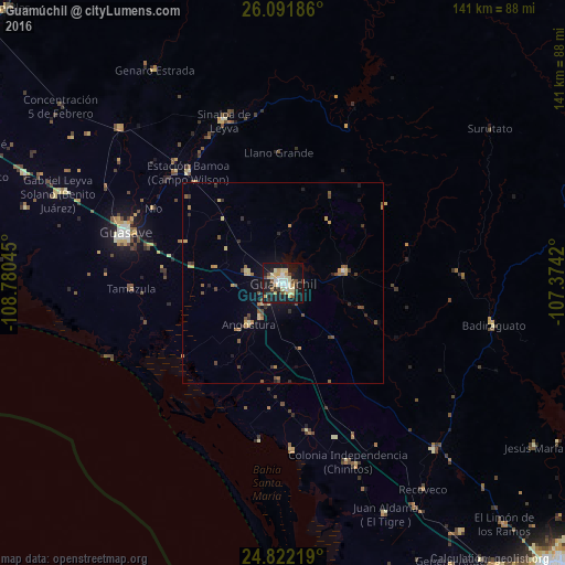
Analysis of Guamúchil night lights 2016
Square area 10x10 km:
 4.96%
4.96%90-99
6.55%80-89
11.31%70-79
6.55%60-69
0%50-59
3.97%40-49
3.77%30-39
4.17%20-29
7.54%10-19
45.63%0-9
5.56%Square area 50x50 km:
0.21%90-99
0.29%80-89
0.8%70-79
0.68%60-69
0.45%50-59
0.66%40-49
0.72%30-39
0.51%20-29
0.76%10-19
2.92%0-9
92.01%Clear (daylight) street map image can be seen on geolist.org.
Map coordinates:
26° 5' 30.7" North, 108° 46' 49.6" West
25° 27' 31.3" North, 108° 4' 38.4" West
24° 49' 19.9" North, 107° 22' 27.1" West
Some cities around Guamúchil sort by population:
• Guasave
41 km =25.5 mi,  287°
287°
• La Reforma
42 km =26.1 mi,  177°
177°
• Estacion Bamoa
36.5 km =22.7 mi,  319°
319°
• Pericos
56.6 km =35.2 mi,  137°
137°
• Naranjo
56 km =34.8 mi,  313°
313°
• Mocorito
16 km =9.9 mi,  80°
80°
• Sinaloa de Leyva
42.9 km =26.7 mi,  340°
340°
• Angostura
13.3 km =8.3 mi,  219°
219°
4005297 (p: 63,743)
Sources (retrieved 2019-11-25):
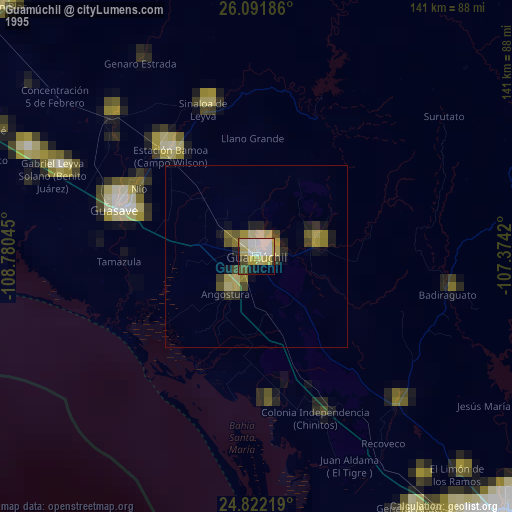
» NASA, Earths city lights 1995
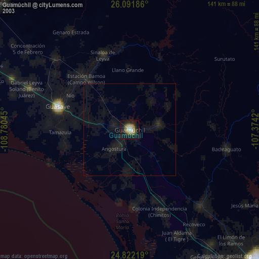
» NASA city lights 2003
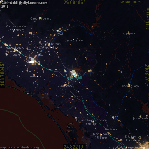
» Earth at Night: Flat Maps 2012, 2016