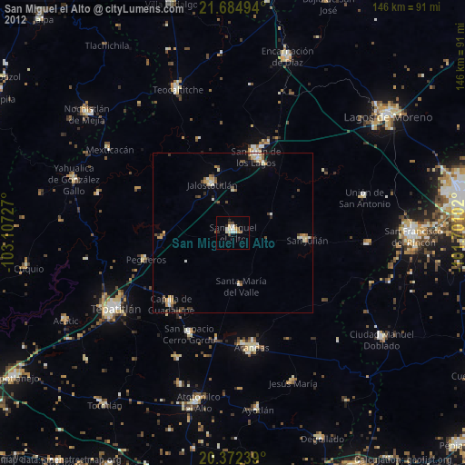
San Miguel el Alto night lights from space
Night Light of San Miguel el Alto (Jalisco) from space (Mexico) Src. Average luminocity for 10x10km area is 13.2024% and for 50x50km: 3.8208%.
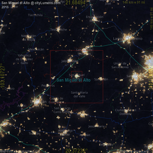
Analysis of San Miguel el Alto night lights 2016
Square area 10x10 km:
 0.2%
0.2%90-99
2.18%80-89
3.17%70-79
3.97%60-69
0.79%50-59
0.99%40-49
2.18%30-39
0.79%20-29
0%10-19
0.6%0-9
85.12%Square area 50x50 km:
0.18%90-99
0.55%80-89
0.8%70-79
0.55%60-69
0.33%50-59
0.44%40-49
0.72%30-39
0.46%20-29
0.53%10-19
1.76%0-9
93.7%Clear (daylight) street map image can be seen on geolist.org.
Map coordinates:
21° 41' 5.8" North, 103° 6' 26.2" West
21° 1' 48.4" North, 102° 24' 14.9" West
20° 22' 20.6" North, 101° 42' 3.7" West
Some cities around San Miguel el Alto sort by population:
• Arandas
36.6 km =22.7 mi,  170°
170°
• San Juan de los Lagos
25.5 km =15.8 mi,  17°
17°
• Jalostotitlán
16.5 km =10.3 mi,  337°
337°
• Capilla de Guadalupe
29.8 km =18.5 mi,  220°
220°
• San Julián
23.4 km =14.5 mi,  95°
95°
• San Ignacio Cerro Gordo
34.4 km =21.4 mi,  203°
203°
• Unión de San Antonio
42.7 km =26.5 mi,  75°
75°
• San Diego de Alejandría
42.6 km =26.5 mi, 95°
3985323 (p: 23,982)
Sources (retrieved 2019-11-25):
» Earth at Night: Flat Maps 2012, 2016