San Luis Río Colorado night lights from space
Night Light of San Luis Río Colorado (Sonora) from space (Mexico) Src. Average luminocity for 10x10km area is 69.7418% and for 50x50km: 9.6733%.
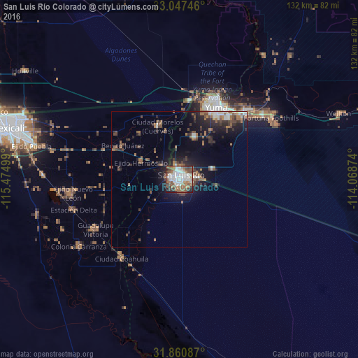


Analysis of San Luis Río Colorado night lights 2016
Square area 10x10 km:
 21.25%
90-99
19.05%80-89
1.47%70-79
3.66%60-69
12.82%50-59
18.86%40-49
7.69%30-39
5.86%20-29
6.04%10-19
3.3%0-9
0%Square area 50x50 km:
1.43%90-99
1.46%80-89
0.27%70-79
0.3%60-69
2.06%50-59
2.27%40-49
1.66%30-39
1.91%20-29
2.59%10-19
6.31%0-9
79.74%Clear (daylight) street map image can be seen on geolist.org.
Map coordinates:
33° 2' 50.9" North, 115° 28' 30" West
32° 27' 22" North, 114° 46' 18.7" West
31° 51' 39.1" North, 114° 4' 7.5" West
Some cities around San Luis Río Colorado sort by population:
• Yuma, US
33 km =20.5 mi,  24°
24°
• Fortuna Foothills, US
40.5 km =25.2 mi,  56°
56°
• Guadalupe Victoria
36.4 km =22.6 mi,  239°
239°
• Somerton, US
16.7 km =10.4 mi, 20°
• Estación Coahuila
36.2 km =22.5 mi,  216°
216°
• Ciudad Coahuila (Kilómetro Cincuenta y Siete)
36.2 km =22.5 mi, 216°
• Tecolots
23.3 km =14.5 mi,  301°
301°
• Hermosillo
15.4 km =9.6 mi,  293°
293°
3985604 (p: 158,089)
Sources (retrieved 2019-11-25):
» NASA, Earths city lights 1995
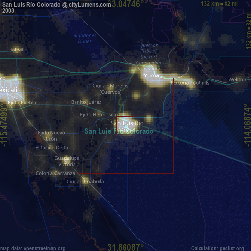
» NASA city lights 2003
» Earth at Night: Flat Maps 2012, 2016