San José Iturbide night lights from space
Night Light of San José Iturbide (Guanajuato) from space (Mexico) Src. Average luminocity for 10x10km area is 39.7758% and for 50x50km: 11.6718%.
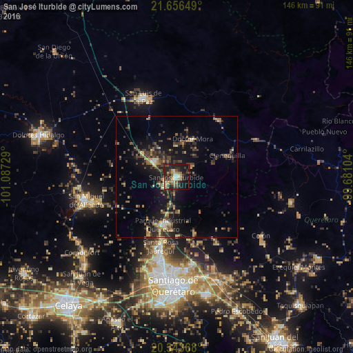
Analysis of San José Iturbide night lights 2016
Square area 10x10 km:
 2.58%
2.58%90-99
3.57%80-89
6.15%70-79
6.55%60-69
9.13%50-59
5.56%40-49
7.94%30-39
8.73%20-29
19.25%10-19
25.2%0-9
5.36%Square area 50x50 km:
0.35%90-99
0.57%80-89
1.35%70-79
1.64%60-69
1.77%50-59
1.65%40-49
3.21%30-39
3.34%20-29
4.25%10-19
10.11%0-9
71.74%Clear (daylight) street map image can be seen on geolist.org.
Map coordinates:
21° 39' 23.4" North, 101° 5' 14.2" West
21° 0' 5.5" North, 100° 23' 3" West
20° 20' 37.2" North, 99° 40' 51.7" West
Some cities around San José Iturbide sort by population:
• San Miguel de Allende
38.6 km =24 mi,  255°
255°
• San Luis de la Paz
35.7 km =22.2 mi,  337°
337°
• Santa Rosa Jauregui
29.7 km =18.5 mi,  192°
192°
• Juriquilla
33 km =20.5 mi, 193°
• Misión de Chichimecas
33.3 km =20.7 mi, 341°
• La Pradera
38.3 km =23.8 mi,  173°
173°
• Amazcala
35.4 km =22 mi,  159°
159°
• Doctor Mora
17 km =10.6 mi,  23°
23°
3986088 (p: 23,471)
Sources (retrieved 2019-11-25):
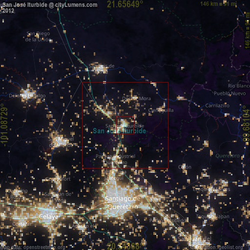
» Earth at Night: Flat Maps 2012, 2016