Misión de Chichimecas night lights from space
Night Light of Misión de Chichimecas (Guanajuato) from space (Mexico) Src. Average luminocity for 10x10km area is 24.9375% and for 50x50km: 5.7668%.
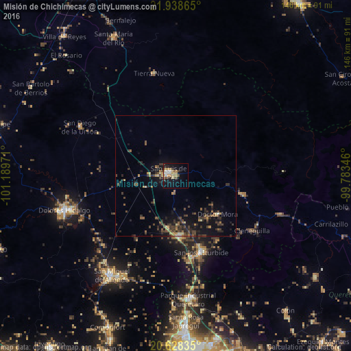
Analysis of Misión de Chichimecas night lights 2016
Square area 10x10 km:
 3.41%
3.41%90-99
2.65%80-89
4.36%70-79
6.06%60-69
1.7%50-59
2.65%40-49
3.98%30-39
2.27%20-29
2.65%10-19
23.86%0-9
46.4%Square area 50x50 km:
0.22%90-99
0.27%80-89
0.49%70-79
0.81%60-69
0.65%50-59
0.93%40-49
1.56%30-39
1.97%20-29
1.7%10-19
5.2%0-9
86.19%Clear (daylight) street map image can be seen on geolist.org.
Map coordinates:
21° 56' 19.1" North, 101° 11' 23" West
21° 17' 5.9" North, 100° 29' 11.7" West
20° 37' 42.1" North, 99° 47' 0.5" West
Some cities around Misión de Chichimecas sort by population:
• San Miguel de Allende
49 km =30.4 mi,  212°
212°
• Dolores Hidalgo Cuna de la Independencia Nacional
48.4 km =30.1 mi,  252°
252°
• San Luis de la Paz
3.5 km =2.2 mi,  293°
293°
• San José Iturbide
33.3 km =20.7 mi,  161°
161°
• Santa Rosa Jauregui
60.6 km =37.7 mi,  176°
176°
• San Diego de la Unión
44.9 km =27.9 mi,  296°
296°
• Tierra Nueva
43.6 km =27.1 mi,  348°
348°
• Doctor Mora
23.5 km =14.6 mi,  132°
132°
3995699 (p: 6,716)
Sources (retrieved 2019-11-25):
» Earth at Night: Flat Maps 2012, 2016