San Gabriel Tetzoyocán night lights from space
Night Light of San Gabriel Tetzoyocán (Puebla) from space (Mexico) Src. Average luminocity for 10x10km area is 16.6612% and for 50x50km: 16.0936%.
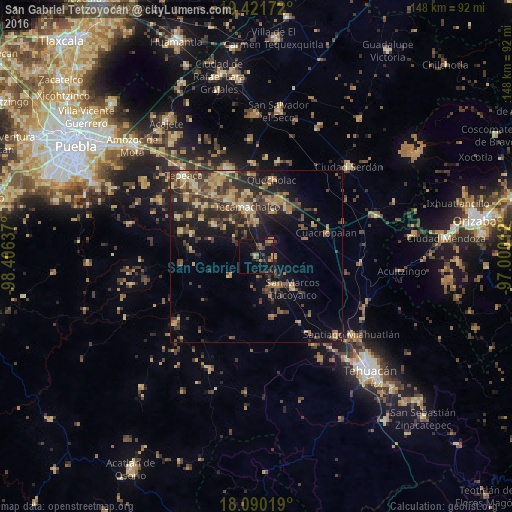
Analysis of San Gabriel Tetzoyocán night lights 2016
Square area 10x10 km:
 0%
0%90-99
0%80-89
1.65%70-79
2.48%60-69
4.13%50-59
1.86%40-49
3.93%30-39
5.58%20-29
3.31%10-19
16.53%0-9
60.54%Square area 50x50 km:
0.15%90-99
0.48%80-89
3.26%70-79
2.47%60-69
3.53%50-59
1.95%40-49
4.5%30-39
4.71%20-29
5.51%10-19
9.32%0-9
64.13%Clear (daylight) street map image can be seen on geolist.org.
Map coordinates:
19° 25' 18.2" North, 98° 24' 22.9" West
18° 45' 26.2" North, 97° 42' 11.7" West
18° 5' 24.7" North, 97° 0' 0.4" West
Some cities around San Gabriel Tetzoyocán sort by population:
• Tecamachalco
14.4 km =8.9 mi,  347°
347°
• San Marcos Tlacoyalco
14 km =8.7 mi,  131°
131°
• Tlacotepec
9.7 km =6 mi,  149°
149°
• Xaltepec
17.1 km =10.6 mi,  35°
35°
• Santiago Alseseca
9.8 km =6.1 mi,  357°
357°
• Yehualtepec
6.1 km =3.8 mi,  46°
46°
• Tochtepec
15.5 km =9.6 mi,  305°
305°
• Xochitlan Todos Santos
9.7 km =6 mi,  232°
232°
3515735 (p: 6,060)
Sources (retrieved 2019-11-25):
» Earth at Night: Flat Maps 2012, 2016