San Ciro de Acosta night lights from space
Night Light of San Ciro de Acosta (San Luis Potosí) from space (Mexico) Src. Average luminocity for 10x10km area is 1.7424% and for 50x50km: 0.5259%.
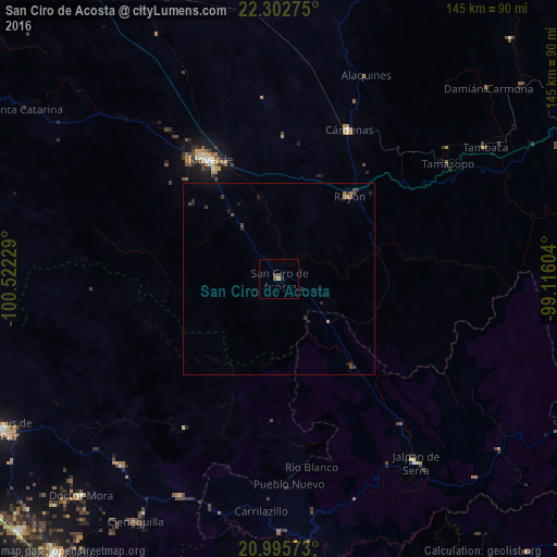
Analysis of San Ciro de Acosta night lights 2016
Square area 10x10 km:
 0%
0%90-99
0%80-89
0%70-79
0.38%60-69
0.38%50-59
0.57%40-49
0.95%30-39
0.76%20-29
0.76%10-19
0%0-9
96.21%Square area 50x50 km:
0%90-99
0%80-89
0%70-79
0.07%60-69
0.09%50-59
0.11%40-49
0.2%30-39
0.27%20-29
0.29%10-19
0.11%0-9
98.86%Clear (daylight) street map image can be seen on geolist.org.
Map coordinates:
22° 18' 9.9" North, 100° 31' 20.2" West
21° 39' 2.6" North, 99° 49' 9" West
20° 59' 44.6" North, 99° 6' 57.7" West
Some cities around San Ciro de Acosta sort by population:
• Rioverde
36.1 km =22.4 mi,  329°
329°
• Ciudad Fernández
37.8 km =23.5 mi, 328°
• Cárdenas
43.1 km =26.8 mi,  25°
25°
• Jalpan
60.1 km =37.3 mi,  143°
143°
• Misión de Chichimecas
80.1 km =49.8 mi,  239°
239°
• Rayón
28.1 km =17.5 mi,  40°
40°
• Tierra Nueva
77.9 km =48.4 mi,  271°
271°
• Doctor Mora
76.7 km =47.7 mi,  222°
222°
3519570 (p: 7,026)
Sources (retrieved 2019-11-25):
» Earth at Night: Flat Maps 2012, 2016