Romita night lights from space
Night Light of Romita (Guanajuato) from space (Mexico) Src. Average luminocity for 10x10km area is 31.748% and for 50x50km: 31.5779%.
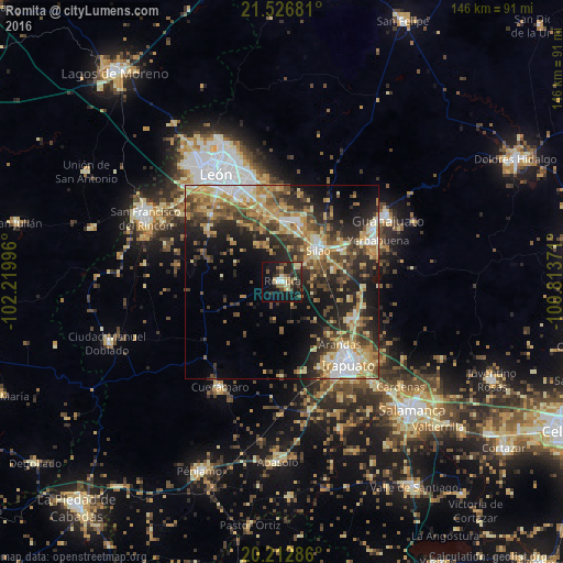
Analysis of Romita night lights 2016
Square area 10x10 km:
 1.39%
1.39%90-99
4.37%80-89
6.75%70-79
4.17%60-69
2.98%50-59
3.77%40-49
4.56%30-39
7.34%20-29
14.88%10-19
30.36%0-9
19.44%Square area 50x50 km:
3.29%90-99
3.77%80-89
5.86%70-79
5.75%60-69
4.63%50-59
4.42%40-49
7.16%30-39
5.33%20-29
9.47%10-19
13.22%0-9
37.09%Clear (daylight) street map image can be seen on geolist.org.
Map coordinates:
21° 31' 36.5" North, 102° 13' 11.9" West
20° 52' 16.6" North, 101° 31' 0.6" West
20° 12' 46.3" North, 100° 48' 49.4" West
Some cities around Romita sort by population:
• Irapuato
27.3 km =17 mi,  142°
142°
• Silao
12.3 km =7.6 mi,  49°
49°
• Yerbabuena
27.2 km =16.9 mi,  67°
67°
• Arandas
22.1 km =13.7 mi, 137°
• Santa Teresa
23 km =14.3 mi,  64°
64°
• Duarte
24 km =14.9 mi,  358°
358°
• La Aldea
5.2 km =3.2 mi, 49°
• Villas de Irapuato
23.5 km =14.6 mi,  150°
150°
3988462 (p: 21,176)
Sources (retrieved 2019-11-25):
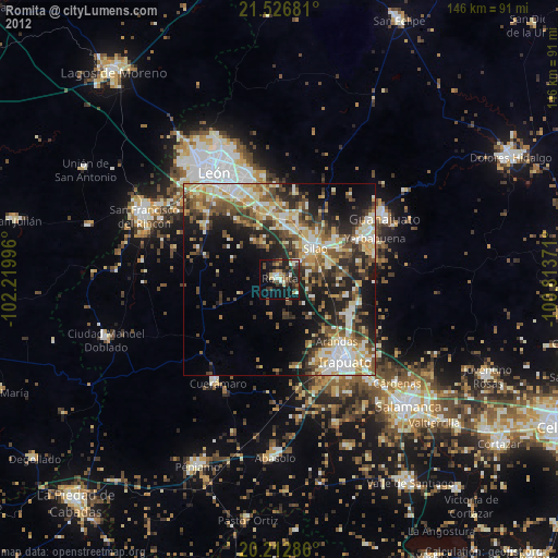
» Earth at Night: Flat Maps 2012, 2016