Río Blanco night lights from space
Night Light of Río Blanco (Veracruz) from space (Mexico) Src. Average luminocity for 10x10km area is 47.8268% and for 50x50km: 16.0996%.
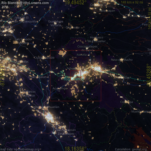
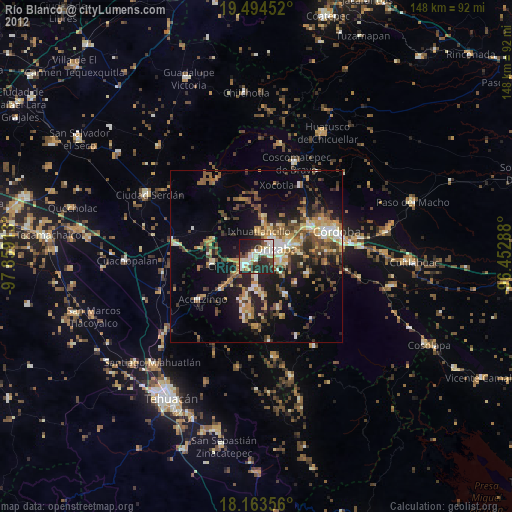
Analysis of Río Blanco night lights 2016
Square area 10x10 km:
 7.36%
7.36%90-99
11.26%80-89
7.58%70-79
4.98%60-69
4.98%50-59
3.68%40-49
6.06%30-39
7.79%20-29
26.19%10-19
17.97%0-9
2.16%Square area 50x50 km:
1.23%90-99
1.83%80-89
1.59%70-79
2.36%60-69
3.97%50-59
1.88%40-49
3.57%30-39
3.39%20-29
4.12%10-19
10.19%0-9
65.88%Clear (daylight) street map image can be seen on geolist.org.
Map coordinates:
19° 29' 40.3" North, 97° 51' 32.9" West
18° 49' 49.3" North, 97° 9' 21.6" West
18° 9' 48.8" North, 96° 27' 10.4" West
Some cities around Río Blanco sort by population:
• Orizaba
6.4 km =4 mi,  67°
67°
• Ciudad Mendoza
3.6 km =2.2 mi,  221°
221°
• Ixtaczoquitlán
10.2 km =6.3 mi,  75°
75°
• Nogales
0.8 km =0.5 mi,  248°
248°
• Palmira
7.5 km =4.7 mi,  38°
38°
• Rafael Delgado
9.2 km =5.7 mi,  104°
104°
• Jalapilla
7.1 km =4.4 mi,  93°
93°
• Unión y Progreso
6.1 km =3.8 mi, 39°
3520274 (p: 40,611)
Sources (retrieved 2019-11-25):
» Earth at Night: Flat Maps 2012, 2016