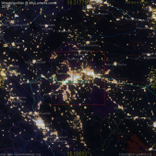
Ixtaczoquitlán night lights from space
Night Light of Ixtaczoquitlán (Veracruz) from space (Mexico) Src. Average luminocity for 10x10km area is 67.6623% and for 50x50km: 17.2792%.
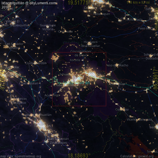
Analysis of Ixtaczoquitlán night lights 2016
Square area 10x10 km:
 11.69%
90-99
16.02%80-89
10.82%70-79
11.26%60-69
11.9%50-59
9.31%40-49
10.61%30-39
11.47%20-29
6.71%10-19
0.22%0-9
0%Square area 50x50 km:
1.24%90-99
1.9%80-89
1.79%70-79
2.57%60-69
4.11%50-59
2.07%40-49
3.68%30-39
3.56%20-29
4.86%10-19
12.39%0-9
61.83%Clear (daylight) street map image can be seen on geolist.org.
Map coordinates:
19° 31' 3.8" North, 97° 45' 55.5" West
18° 51' 13.1" North, 97° 3' 44.2" West
18° 11' 12.9" North, 96° 21' 33" West
Some cities around Ixtaczoquitlán sort by population:
• Orizaba
3.9 km =2.4 mi,  267°
267°
• Fortín de las Flores
8.9 km =5.5 mi,  47°
47°
• Palmira
6.1 km =3.8 mi,  302°
302°
• Rafael Delgado
4.9 km =3 mi,  191°
191°
• Atzacan
6.3 km =3.9 mi,  339°
339°
• Jalapilla
4.1 km =2.5 mi,  222°
222°
• Unión y Progreso
6.4 km =4 mi,  289°
289°
• Cuautlapán
4.9 km =3 mi,  57°
57°
3526696 (p: 26,187)
Sources (retrieved 2019-11-25):
» Earth at Night: Flat Maps 2012, 2016