Orizaba night lights from space
Night Light of Orizaba (Veracruz) from space (Mexico) Src. Average luminocity for 10x10km area is 71.7771% and for 50x50km: 17.1299%.
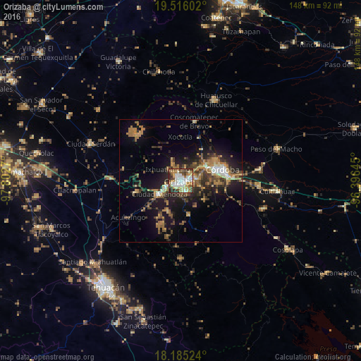

Analysis of Orizaba night lights 2016
Square area 10x10 km:
 16.02%
90-99
21.21%80-89
9.96%70-79
9.96%60-69
9.09%50-59
7.14%40-49
10.61%30-39
11.04%20-29
4.98%10-19
0%0-9
0%Square area 50x50 km:
1.24%90-99
1.89%80-89
1.76%70-79
2.57%60-69
4.19%50-59
2.02%40-49
3.62%30-39
3.52%20-29
4.72%10-19
11.55%0-9
62.92%Clear (daylight) street map image can be seen on geolist.org.
Map coordinates:
19° 30' 57.7" North, 97° 48' 9.7" West
18° 51' 7" North, 97° 5' 58.5" West
18° 11' 6.9" North, 96° 23' 47.2" West
Some cities around Orizaba sort by population:
• Río Blanco
6.4 km =4 mi,  247°
247°
• Ixtaczoquitlán
3.9 km =2.4 mi,  87°
87°
• Nogales
7.2 km =4.5 mi, 248°
• Palmira
3.6 km =2.2 mi,  340°
340°
• Rafael Delgado
5.5 km =3.4 mi,  147°
147°
• Atzacan
6.4 km =4 mi,  15°
15°
• Jalapilla
3.1 km =1.9 mi,  157°
157°
• Unión y Progreso
3.1 km =1.9 mi,  318°
318°
3522307 (p: 120,844)
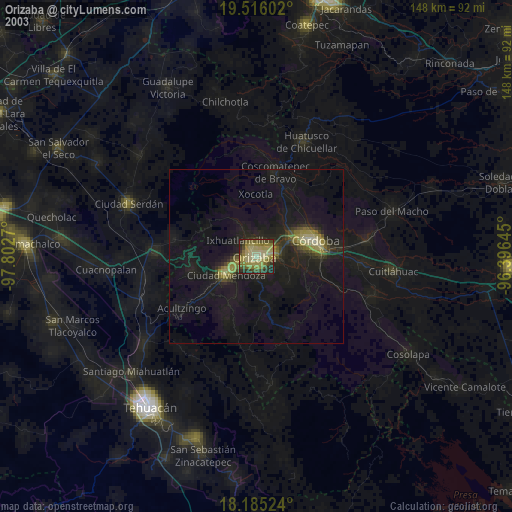
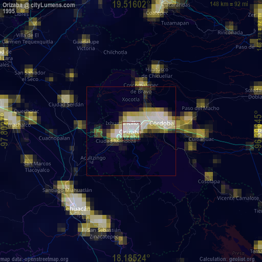
Sources (retrieved 2019-11-25):
» NASA, Earths city lights 1995
» NASA city lights 2003
» Earth at Night: Flat Maps 2012, 2016