Jalapilla night lights from space
Night Light of Jalapilla (Veracruz) from space (Mexico) Src. Average luminocity for 10x10km area is 65.1277% and for 50x50km: 17.0825%.
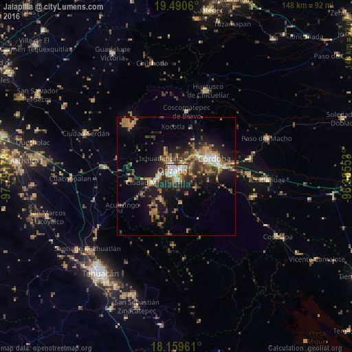
Analysis of Jalapilla night lights 2016
Square area 10x10 km:
 14.72%
90-99
19.91%80-89
8.87%70-79
8.44%60-69
5.63%50-59
4.55%40-49
7.14%30-39
9.74%20-29
16.23%10-19
4.76%0-9
0%Square area 50x50 km:
1.24%90-99
1.89%80-89
1.75%70-79
2.55%60-69
4.13%50-59
2.01%40-49
3.67%30-39
3.59%20-29
4.71%10-19
11.73%0-9
62.72%Clear (daylight) street map image can be seen on geolist.org.
Map coordinates:
19° 29' 26.2" North, 97° 47' 30.4" West
18° 49' 35.1" North, 97° 5' 19.1" West
18° 9' 34.6" North, 96° 23' 7.9" West
Some cities around Jalapilla sort by population:
• Orizaba
3.1 km =1.9 mi,  337°
337°
• Río Blanco
7.1 km =4.4 mi,  273°
273°
• Ixtaczoquitlán
4.1 km =2.5 mi,  42°
42°
• Nogales
7.8 km =4.8 mi, 271°
• Palmira
6.7 km =4.2 mi, 339°
• Rafael Delgado
2.5 km =1.6 mi,  135°
135°
• Unión y Progreso
6.1 km =3.8 mi,  328°
328°
• Cuautlapán
8.9 km =5.5 mi,  50°
50°
3526613 (p: 8,245)
Sources (retrieved 2019-11-25):
» Earth at Night: Flat Maps 2012, 2016