Puerto Vallarta night lights from space
Night Light of Puerto Vallarta (Jalisco) from space (Mexico) Src. Average luminocity for 10x10km area is 39.9091% and for 50x50km: 8.1944%.
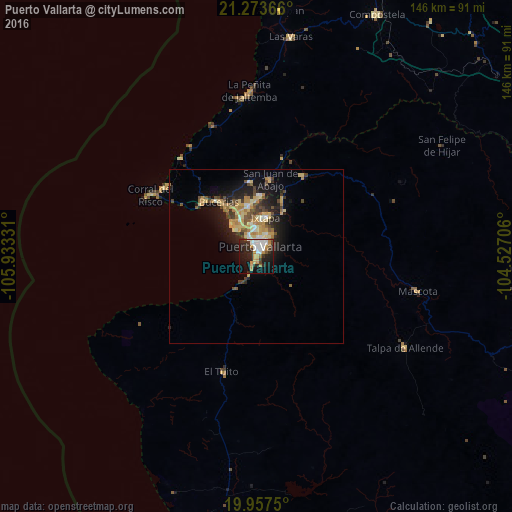
Analysis of Puerto Vallarta night lights 2016
Square area 10x10 km:
 9.28%
9.28%90-99
8.14%80-89
3.22%70-79
6.25%60-69
3.98%50-59
2.65%40-49
2.08%30-39
5.49%20-29
17.23%10-19
25%0-9
16.67%Square area 50x50 km:
0.64%90-99
0.96%80-89
1.56%70-79
1.69%60-69
1.11%50-59
0.74%40-49
1.4%30-39
1.21%20-29
2.41%10-19
5.54%0-9
82.73%Clear (daylight) street map image can be seen on geolist.org.
Map coordinates:
21° 16' 25.2" North, 105° 55' 59.9" West
20° 37' 1.2" North, 105° 13' 48.6" West
19° 57' 27" North, 104° 31' 37.4" West
Some cities around Puerto Vallarta sort by population:
• Ixtapa
11.4 km =7.1 mi,  13°
13°
• San José del Valle
16.3 km =10.1 mi,  0°
0°
• Mezcales
13.8 km =8.6 mi,  336°
336°
• San Vicente
14.8 km =9.2 mi,  351°
351°
• Bucerías
18.9 km =11.7 mi,  325°
325°
• Las Juntas
9.5 km =5.9 mi, 350°
• Las Jarretaderas
9.5 km =5.9 mi, 331°
• El Porvenir
15.3 km =9.5 mi,  355°
355°
3991328 (p: 203,342)
Sources (retrieved 2019-11-25):
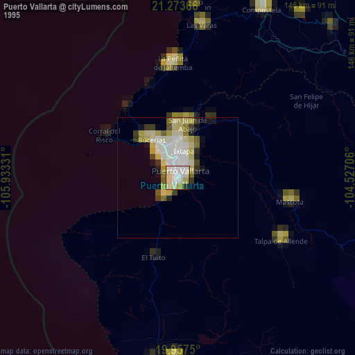
» NASA, Earths city lights 1995
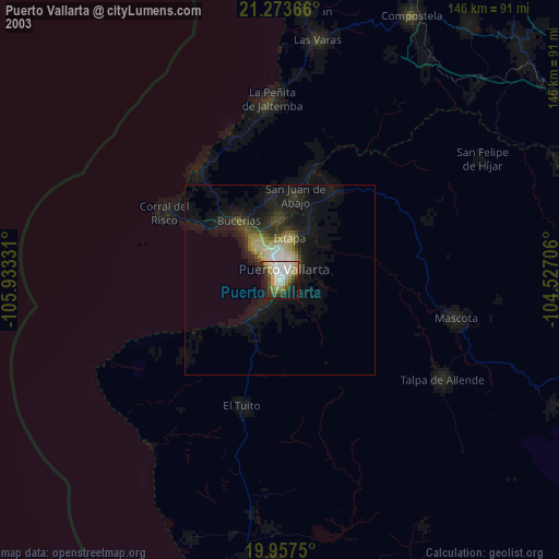
» NASA city lights 2003
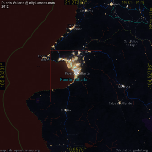
» Earth at Night: Flat Maps 2012, 2016